Exploring never gets old for me. It was Saturday afternoon and time to get out of the house. Making my way through the smoke from Canada’s wildfires and the really strange streets of the Tangletown neighborhood in Minneapolis, it was time to find the Washburn Water Tower.
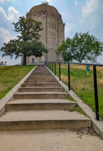
It’s long walk to the top but worth it! (Photo by Chad Smith)
The first observation was Tangletown is the right name for that neighborhood. Whoever put those streets together maybe had one too many drinks with dinner. Nonetheless, it was time to find the tower, and for a good reason.
It looked like a structure you’d see somewhere near a castle in any one of the Lord of the Rings movies. But let’s delve into a bit of history first.
The 110-foot concrete cylinder was constructed in 1932 and sits at the top of a hill in Tangletown. A book titled “Secret Twin Cities, a Guide to the Weird, Wonderful, and Obscure” was the perfect exploring manual. It points out that if you aren’t within a block of the structure, you’ll never see the tower because it’s hidden by a combo of dense residential areas and tall trees.
Look at how intricate that carving is! (Photo by Chad Smith)
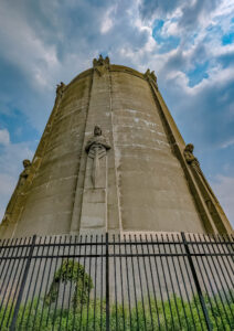
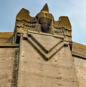
The reason for preserving the old structure was the intricate details builders put into constructing the tower, which is no longer used to supply water. Encircling the top of the tower are eight-foot tall, five-ton eagles with spread wings that look ready for takeoff.
A bit further down the cylinder, it looks like knights are standing guard outside the walls of a castle. Closer to the base are 18-foot tall, eight-ton “guardians of health” holding a perpetual vigil with swords. At a time when Minnesota was in the middle of a deadly typhoid outbreak, the guardians were symbolic protectors of a clean water supply.
Photo by Chad Smith
The tower had a capacity of 1.35 million gallons of water, which it faithfully supplied to the neighborhood until the 1990s. Three men from the neighborhood designed and engineered the structure John Daniels was the sculptor, William Hewitt was the project engineer, and Harry Wild Jones was the lead architect.
Get out and get to exploring. The massive medieval tower is located at 401 Prospect Avenue in Minneapolis, and there’s no charge to get up close and personal with the “tower guards.”
“The Eagles have landed!” (In my best Merry and Pippin voice from LOTR!Lonely sentries guarding the Washburn Water Tower
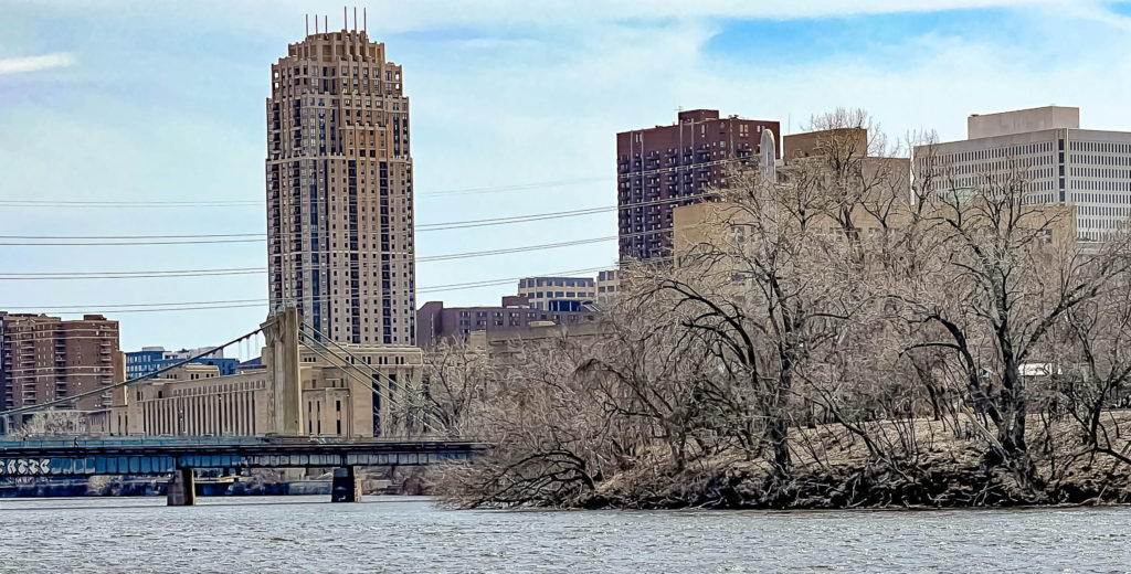
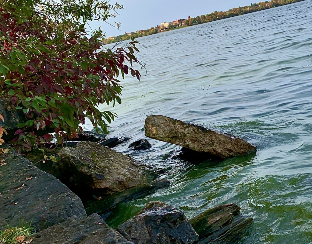
Boom Island Park in Minneapolis is one of my favorite places to explore in the Twin Cities. In fact, it was the first place I went to when I got bit by the exploring bug. Well, now that Derrick moved to Minnesota, it’s time to start showing him some of my favorite places in the Twin Cities (and there are a LOT of them).
Boom Island Park in Minneapolis and what remains of the island it used to be. (Photo by Chad Smith)
The park actually gets its name from the island that it once was. The island was named for the booms that were used to separate logs floated down the Mississippi River to sawmills powered by St. Anthony Falls (another of my favorite spots). Each log cut along the tributaries of the Mississippi River was “branded” by each lumber company that put its own stamp on the end of is logs.
One of the things I love about Boom Island Park is the big city is on one side, the green (it will be at some point!) and the wide open space of the park on the other side. (Photo by Chad Smith)
They were separated using the stamps and directed to the right mill by men working from Boom Island. The sawmills at the falls were eventually replaced by flour mills. What remains of those flour mills makes up Mill Ruins Park, yet another great place to explore in the Twin Cities of Minnesota.
What I love most about the park, besides just how big it is, is the fact that it’s set up next to the Mississippi River. You’ve got the big city on one side, and the open areas of the park on the other side.
My son Derrick appears to be pondered the Mississippi River. He is deep like that :). (Photo by Chad Smith)
The land ceased to be an island a while ago due to a buildup of silt and sawdust. It was bought by the park board with funds from the state legislature through the Metropolitan Council in 1982. The land was bought from a construction company for $2.6 million. That land had been targeted for acquisition in the 1978 plan for the development of the central riverfront as a park by the Riverfront Development Coordinating Board.
At one point, the RDCB even considered converting the land to an island once again, but they decided against it because of the cost. The first phase of the park was dedicated in 1987.
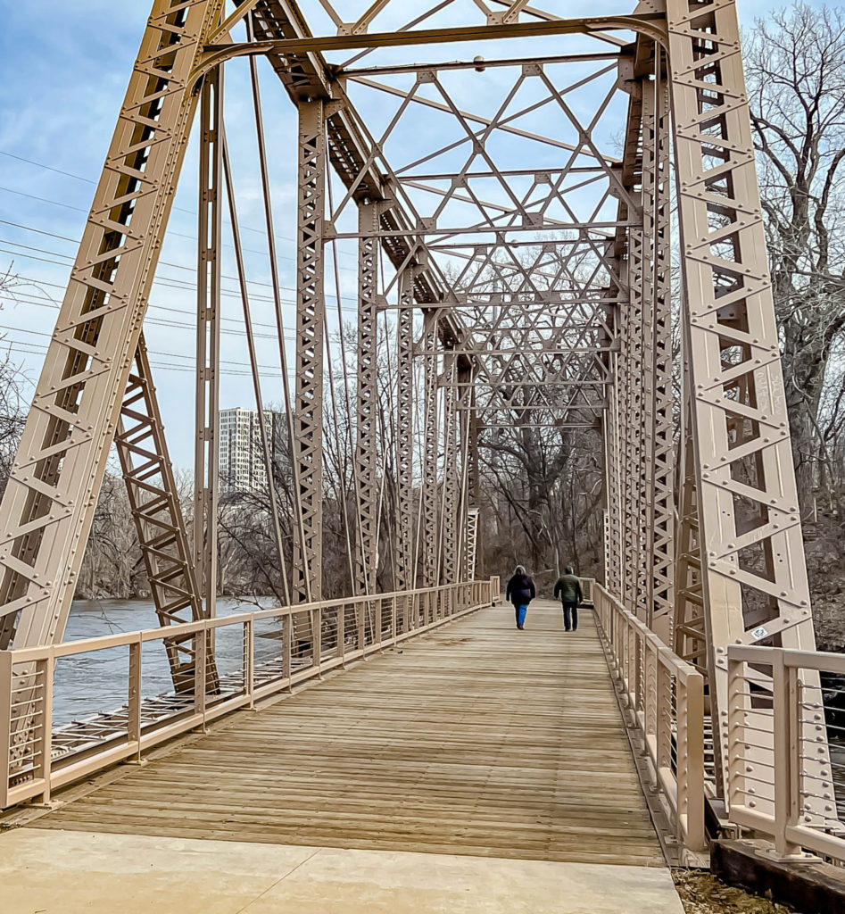
Isn’t this a remarkable old bridge at Boom Island Park? (Photo by Chad Smith)
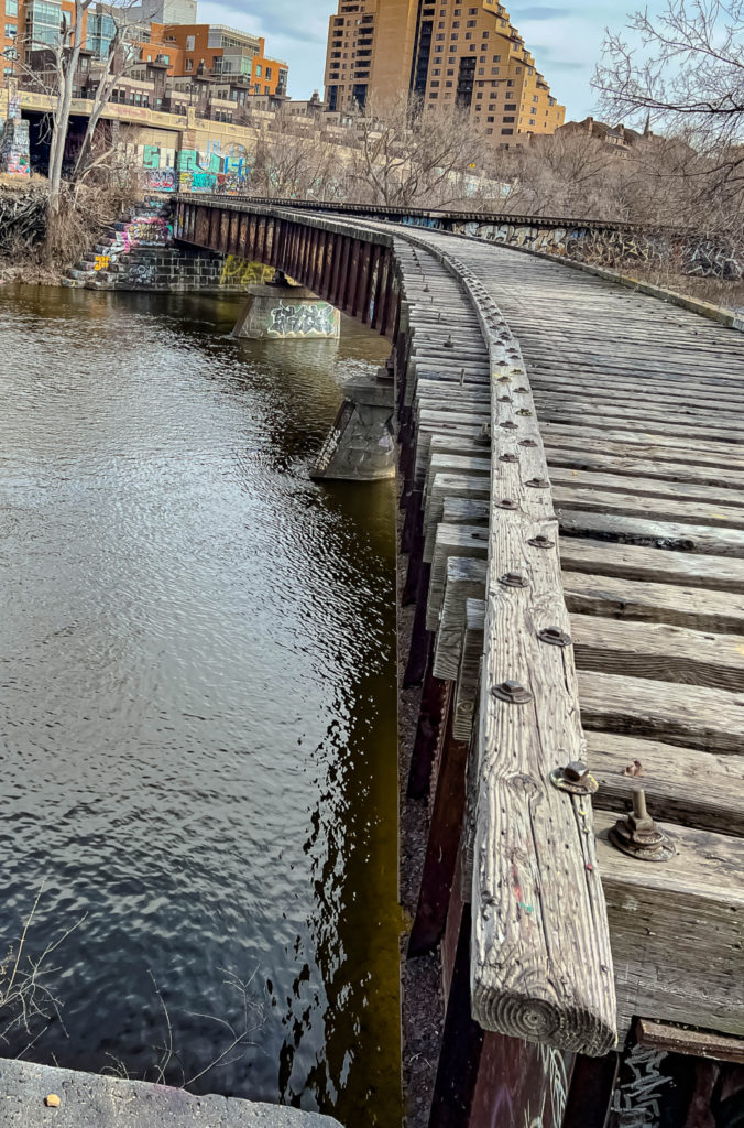
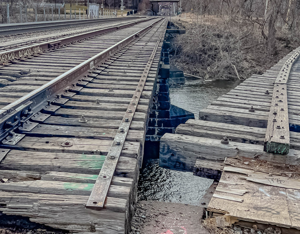
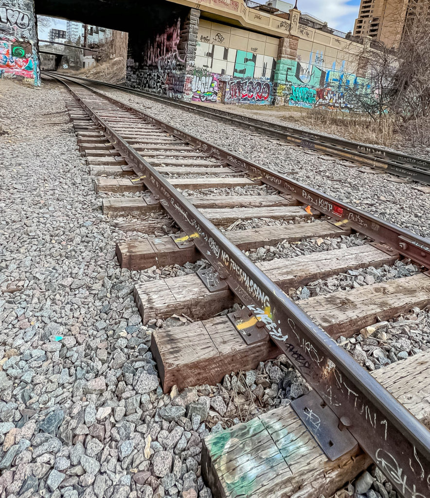
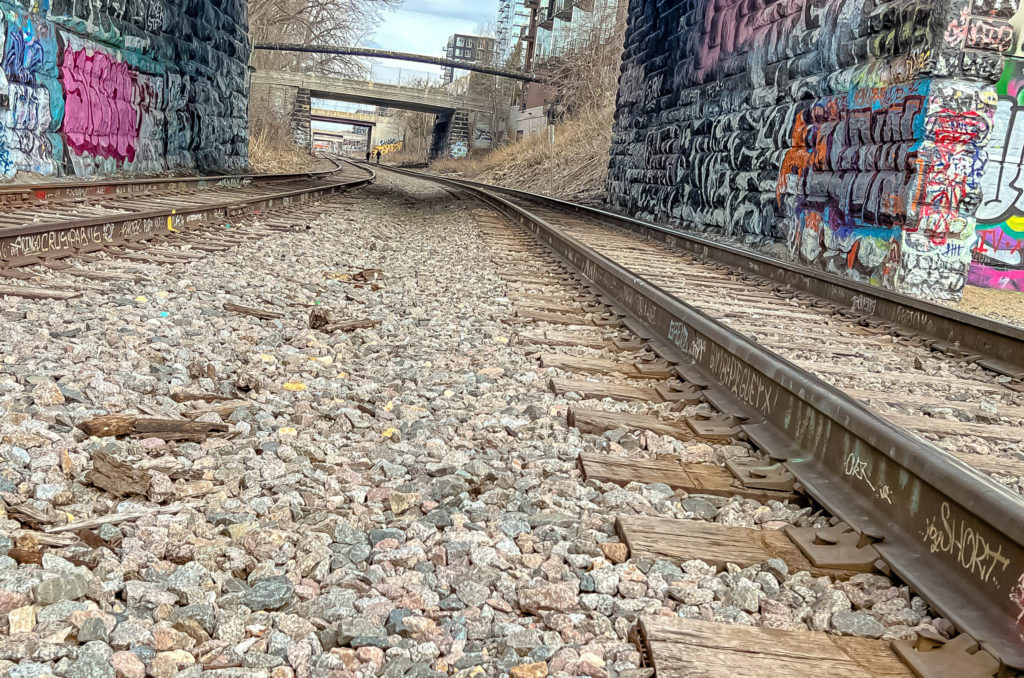
One of my other favorite parts of the park is an old railroad bridge, originally built in 1901 to Nicollet Island, was converted into a bicycle and pedestrian bridge. The bridge was repaired and restored in 2018.
And here is the old railroad bridge. The MOTHER LODE for this old urban explorer.
Photo by Chad SmithOne of my favorite places to go hiking! (Photo by Chad Smith)What I was most surprised at that day is how many people took hiking trips up and down the tracks. (Photo by Chad Smith)
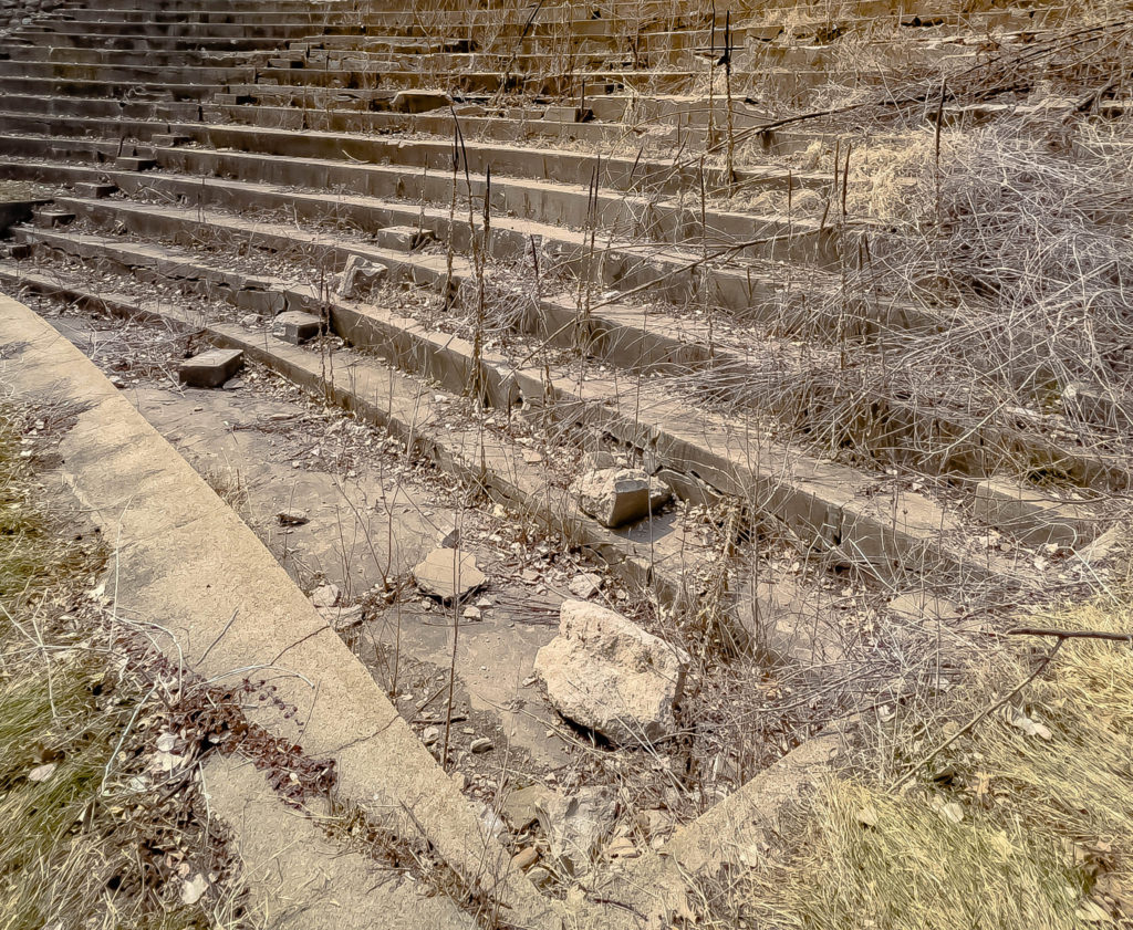
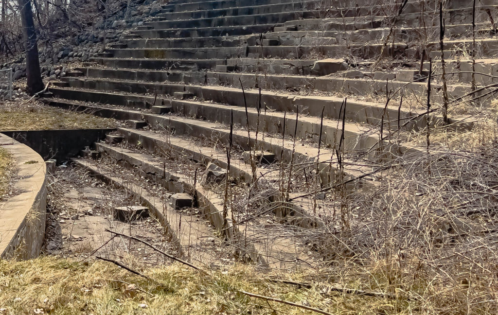
Anoka’s abandoned amphitheater is a sidewalk width away from the busy traffic on 169. (Photo by Chad Smith)
An abandoned amphitheater? Who could resist that?!
Anoka was my next stop on the exploration schedule to check out an old, abandoned amphitheater. With a hat tip to Brendon Maness for the tip, Derrick and I jumped in the car for a quick drive north on 169 and literally almost ran into the amphitheater as it’s a sidewalk away from 169 itself. Bet the traffic noise made for an interesting background to the entertainment folks put on there, back in the day?
My first impression of the amphitheater was an obvious one: this thing has been around a LONG time. The structure was put together back in 1914 on the banks of the Rum River in Anoka. The really interesting part to me is its name: the Windego Park Auditorium and Open-Air Theater. At first, I thought it was Wendigo. Do you know what a Wendigo is? I bet you do if you’re a monster movie buff like me.
The abandoned amphitheater in Anoka, Minnesota, was first built in 1914. (photo by Chad Smith)
The old theater is currently listed in the National Register of Historic Places and had to be a great place to watch a program back then. The location on the bank of the Rum River is beautiful.
Anoka’s citizens back then had a notable interest in outdoor entertainment and recreation. Thaddeus P. Giddings, a promoter of music education who’d been organizing community singalongs in the summer of 1913, took over organizing the programs and entertainment at the amphitheater.
Another gentleman named William Gray Purcell designed the amphitheater, and I thought he did a bang-up job. The stage sits on the flat part of the riverbank, and, as you can see in the pictures, the seats are on the sloping hillside. It had room for an audience of up to 1,600 people in its heyday.
At one time, the abandoned amphitheater held 1,600 people. (Photo by Chad Smith)
At one time, the seating was covered by a colorful retractable awning system designed to protect patrons from the weather. That had to be a must-have during summertime storms and heat waves, am I right? A curved back wall at one time included a box office, entrance doors, and a projection booth, but that part no longer stands.
The orchestra pit was located at the foot of the bleachers. The stage area was off to the left and was nothing more than a flat part of the riverbank. (Photo by Chad Smith)
The theater was used for amateur plays, historical pageants, and other local community musical or meeting events. However, the theater would only thrive as long as Giddings was on hand. Giddings began spending summers at his music camp located in Michigan, and the amphitheater fell into disuse, with the exception of an occasional gathering.
In 1979, Anne Bronken, a University of Minnesota Landscape Architecture Department student, designed a plan to restore the amphitheater. Community organizers patched the concrete and did some cleanup work. A restoration planned as recently as 2010 didn’t happen. Today, the amphitheater has only its seating and orchestra pit left standing, and both are in a deteriorated state.
The view from the amphitheater. The Rum River is in the background and had to make for a fantastic setting to watch a play or concert. (Photo by Chad Smith)
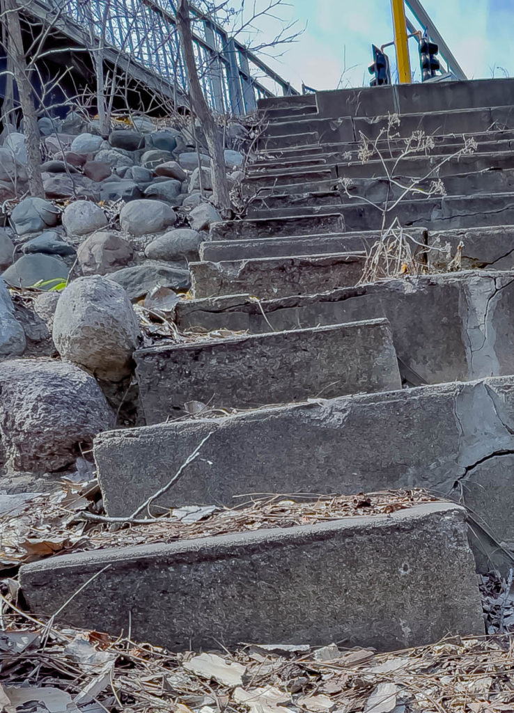
Fergus Falls was calling me over the weekend, and that call finally proved irresistible. I’d heard through the grapevine about the ruins of an old dam along the Otter Tail River that collapsed back in the day. Well, I quit listening after the word “ruins” because I already knew I wanted to see “Broken Down Dam Park.”
Here’s a short video tour of the broken dam
Folks in that area built what’s called a hydroelectric gravity dam on the river in 1907. The dam was built out of concrete and powered a plant called the Fergus Falls City Light Station. The station provided power to city residents for just a year before disaster struck.
Approaching the Broken Down Dam (Photo by Chad Smith)
The large concrete dam suddenly collapsed in 1909, and you did not want to be downriver from the massive wall of water that suddenly rushed down the Otter Tail River. Can you image the roar of all that water moving at once?
One part of the Broken Down Dam near Fergus Falls that gives the dam it’s name. (Photo by Chad Smith
The dam broke at 4:20 in the morning on September 24, 1909, and the power of all that water releasing at once broke not one, not two, not three, but FOUR other dams downriver. Atlas Obscura says there were reports that the water was so powerful, it picked up a ten-ton generator and threw it into the river. Thankfully, no one died as a result of what was a catastrophe of immense size.
A wiki article (which I was able to validate in several other web pages) says that engineers made a crucial mistake when they constructed the dam. They didn’t conduct a proper site evaluation and wound up building on top of a spring. While I don’t pretend to understand how a spring can flow separately from a river while occupying the same space, it only took a year for the water pressure to build up along the foundations. The rupture washed out the concrete foundation and undermined the structural integrity of the dam, which then collapsed.
The Broken Down Dam, first built near Fergus Falls in 1907, collapsed to to an engineering error. (Photo by Chad Smith)
The dam broke in the center, and the rushing water first took out the Kirk Dam, which powered the city’s waterworks. The water then took out the Mount Faith Avenue Bridge before sweeping away the Red River Mill Dam and Woolen Mill Dam. Damage to the two mills totaled $15,000, with the damage in today’s economy equivalent to $432,000 in 2020.
Conspiracy theory alert: The Dayton Hollow Dam, five miles southwest of where the dam broke, was saved from destruction. The dam’s owner, Vernon Wright, had enough warning to hustle down there in time to get the floodgates open. The conspiracy? He also was president of the Otter Tail Power Company.
The biggest break in the Broken Down Dam. (Photo by Chad Smith)
The city of Fergus Falls then hired Otter Tail Power to build transmission lines into town. That helped spawn a local rumor, fueled by the newspaper, that Wright deliberately destroyed the city’s dam by secretly distributing quicksilver from a rowboat to undermine it.
Broken Down Dam Park was established in 1949, an 11-acre parcel of land. When the water level on the Otter Tail River is high, the flow can go fast enough between the blocks of the structure to create Class 3 rapids.
Big tree fell and just about closed the path. (Photo by Chad Smith)
Photo by Chad SmithPhoto by Chad Smith Photo by Chad Smith
Here is the link to my complete photo album from Broken Dam.
Here’s a complete look at the main campus as it stands today.
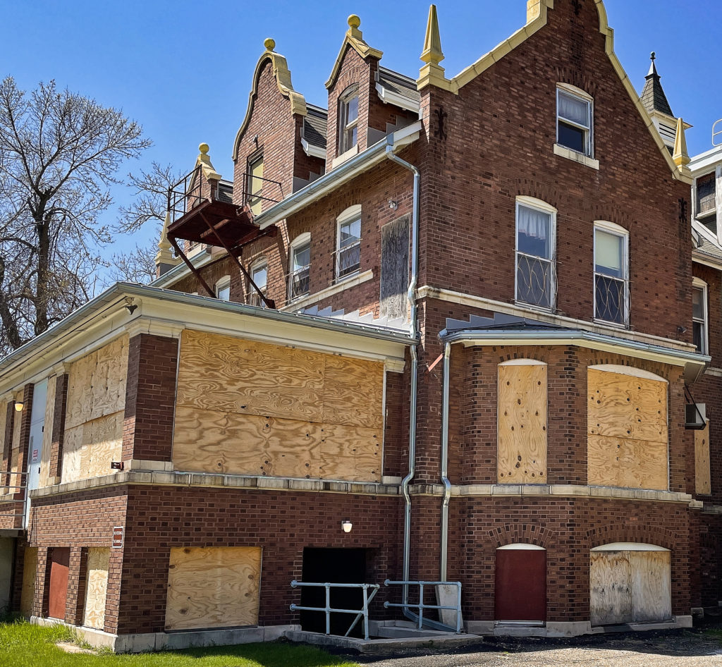
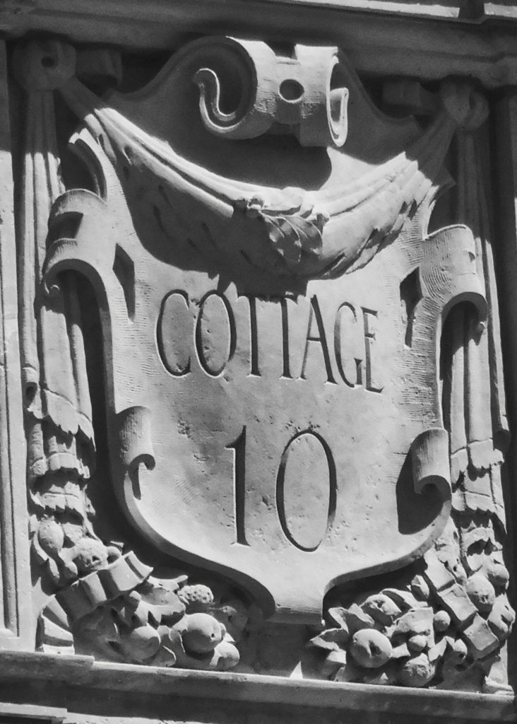
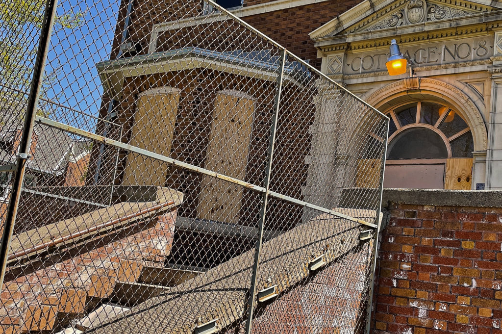
“Anoka State Mental Hospital” – It’s been abandoned since 1999. Just saying the name evokes memories of every single scary movie you’ve watched in recent history, such as those Friday the 13th movies we used to watch as kids. However, like many other abandoned places in the Twin Cities of Minnesota, it seems to be coming back to life.
The abandoned Anoka State Mental Hospital is slowly being brought back to life. (Photo by Chad Smith)
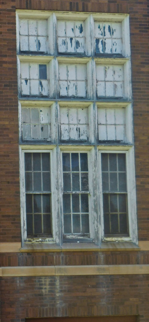
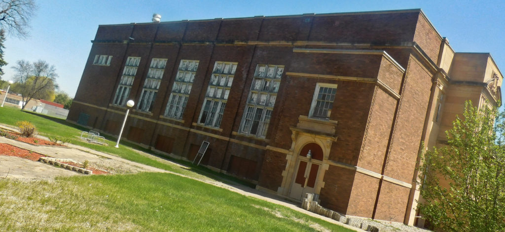
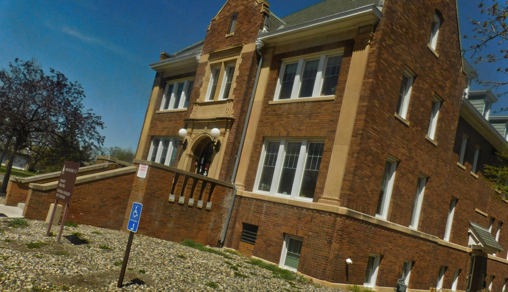
Some of the buildings are still in rough shape, and those are easy to pick out by the plywood in all the windows. Others are in the process of being renovated, and a couple are used now as veterans’ homes. The first thing that jumped out at me was how BIG the campus is. Lots of large brick buildings got built in the shape of a half-circle. It’s enormous!
The brick buildings have every right to look like they’ve been through a lot: they have. A minnpost.com article says the fourth Minnesota state hospital for the insane opened in 1900. The place was quite different from the other three institutions; the Anoka State Mental Hospital was the first to be built in Minnesota according to the cottage plan. The goal was to reduce the institutional feel of the place for its chronic patients.
It was a bright and sunny day when I walked the grounds of the Anoka State Hospital grounds. (Photo by Chad Smith)
They say overcrowding was a big problem at Minnesota’s mental health institutions operating in Rochester, Fergus Falls, and St. Peter. To help alleviate the overcrowding problems, the planning commission chose 650 acres right near the scenic Rum River in Anoka for a fourth site.
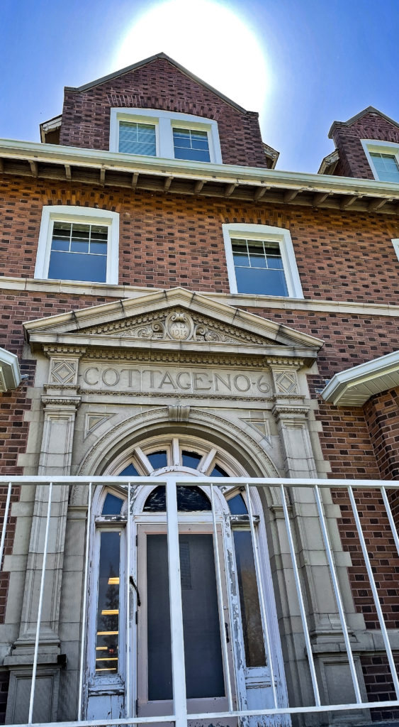
Building the hospital got started in June of 1899, and the first 100 patients (all men) were transferred to the facility on March 14, 1900. The facility began to expand in 1905, adding several cottages, as well as farm and service buildings. By 1917, ten cottages, an auditorium, and a new administration formed in a semicircle at the completed facility.
However, like many mental institutions across the country, history wasn’t always a good thing for the facility. A dramatic series of articles exposed some horrible conditions at the hospital in the mid-1900s. State officials became determined to do something about the problem.
Still some work to do at the Anoka State Hospital. (Photo by Chad Smith)
The atlasobscura.com website says, on Halloween night in 1949, they held a bonfire on the grounds of the Anoka State Mental Hospital. It must have been a big fire as around 359 straitjackets, 196 cuffs, and 91 straps, all different forms of restraints used on the patients, were destroyed. Governor Luther Youngdahl and other officials used the event to show the world that the facility was moving toward more humane forms of treatment.
Conditions did improve for the patients, thanks to the development of new drugs and institutional reforms. Some unfortunate incidents that compromised community safety around the hospital took place here and there over the next several decades. The Anoka State Mental Hospital closed in 1999, and the patients got moved to a nearby facility.
They really don’t want people exploring in their buildings anymore. (Photo by Chad Smith)
Quarry Park and Nature Preserve was the latest stop on the 2021 “Explore Minnesota Before I Run Out of Gas Tour.” I’m not sure if that name is referring to my car or my body because, at my age, I run out of gas a little quicker than I used to, but I digress. I jumped in the car early on a Saturday morning because I could no longer sleep, so what was the point in trying?
Here are some of the highlights from the Quarry Park and Nature Preserve exploration. It’s a great place to do some hiking and picture taking! (Video by Chad Smith)
I spent a couple of hours looking for some abandoned places to explore, but that idea turned out to be a dud. I found myself in Waite Park, Minnesota, up by St. Cloud, and needing a pit stop. I AM 50, after all. Coming into town, I happened to glance to the right and noticed what looked like a couple of large gravel pits. Okay, they weren’t gravel, they were granite, but it’s the only thing I had stored in my brain to compare them to.
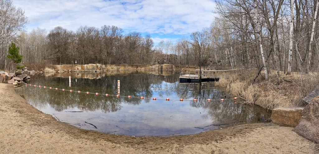
Minnesota parks like the Quarry Park and Nature Preserve in Waite Park are a ton of fun to see. I’ll warn you that while you can swim here, the water gets really deep in a hurry! The deepest one reached 116 feet. (Photo by Chad Smith)
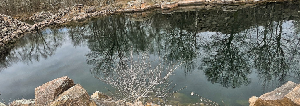
Quarry Park and Nature Preserve is the full name of the place and covers nearly 700 acres of Stearns County land. At one time, it was an actual granite quarry known as the “Hundred Acres Quarry.” Granite is formed by intense heat within the earth and was the “foundation” of a major industry.
The history page on the park’s website points out that the first granite quarry in Central Minnesota was opened in 1863 by two Scotsmen. In the 130 years that followed, central Minnesota granite became an international commodity gracing several buildings located as far away as Singapore.
Roughly a century ago, a type of stone known as Saint Cloud Red Granite was quarried from land which is now part of the park. The Landmark Center and the James J. Hill House in St. Paul, Minnesota, both contain Saint Cloud Red Granite in their structures.
One thing I can’t figure out is whether or not these quarries are filled with stagnant water? I know there’s fish stocked in there (saw the ripples) so they’d need fresh water circulating through there, right? (Photo by Chad Smith)
Though private ownership of the land by local quarry companies continued through 1992, quarrying operations in the present park area quit for good in the mid-1950s. Companies operating quarries on the site including Holes Brothers, Delano Granite, Melrose Granite Company, Empire Quarry Company, and C.L. Atwood.
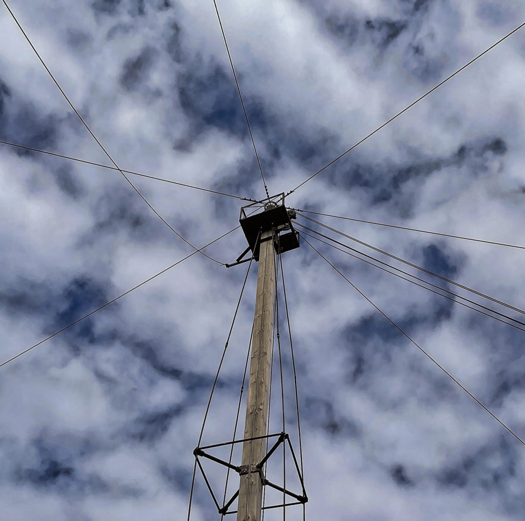
Here is the top of what they call the “Liberty Derrick,” a machine used to lift thousands of tons of granite back when the quarry was in operation and selling granite all over the world. (Photo by Chad Smith)
Over the years, the land gradually reverted to a more natural state. What did Poison Ivy tell Batman in the Arkham Knight game? “Nature always wins.” In 1992, Stearns County bought the site from the Cold Spring Granite Company and added the land to its County Park System. The park opened up on January 1, 1998.
I spent a solid two hours exploring the place, and I might have gotten through a third of the whole thing. You can hike there, go rock climbing, swimming, and even scuba diving in a couple of locations.
You can check out everything the park has to offer here.
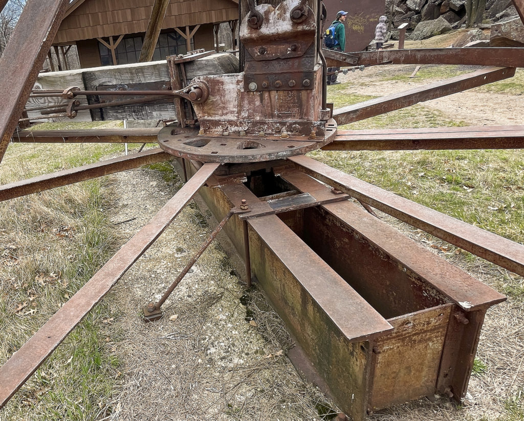
Here’s the bottom of the Liberty Derrick. (Photo by Chad Smith)
Minneapolis is one of my favorite places to explore. It’s nice to see the city trying to get back on its feet after drawing national attention due to the days of rioting that hit the downtown area hard. Driving down 394 East and heading into the city regularly, I kept passing this giant structure that really got my blood pumping.
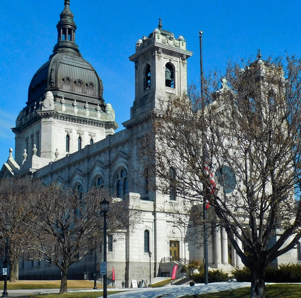
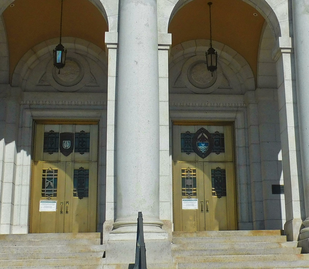
The Basilica of St. Mary’s in Minneapolis, Minnesota. It was built between 1907-1915. (Photo by Chad Smith)
That giant structure is the Basilica of St. Mary’s. Anyone who knows me or follows my explorations, knows I love architecture. It’s one of my favorite things to photograph, especially in the big city where styles can vary widely, sometimes from block to block. St. Mary’s is considered one of the finest examples of Beaux Architecture in the nation.
The big structure was built between 1907 and 1915. They laid the cornerstone of the building was laid at the intersection of 16th Street and Hennepin Avenue. While I don’t pretend to understand exactly what this means, the building was elevated to the rank of minor basilica by Pope Pius XI in 1926. The basilica was added to the National Register of Historic Places in 1975.
Church leaders have done a lot of restoration work as time went by, a costly task because of the structure’s enormous size. By the 1980s, water had begun to leak through dome and into the roof after each snowfall or rainfall. By the mid 1980s, repairs were obviously needed as copper blew off the dome during a storm and plaster chunks fell into the rectory.
St. Mary’s Basilica in Minneapolis. How long did it take for the craftsmen to do something that intricate? (Photo by Chad Smith)
The copper dome and roof were replaced from 1991-1992. The church also restored the paintings and the plasterwork in the dome’s interior.
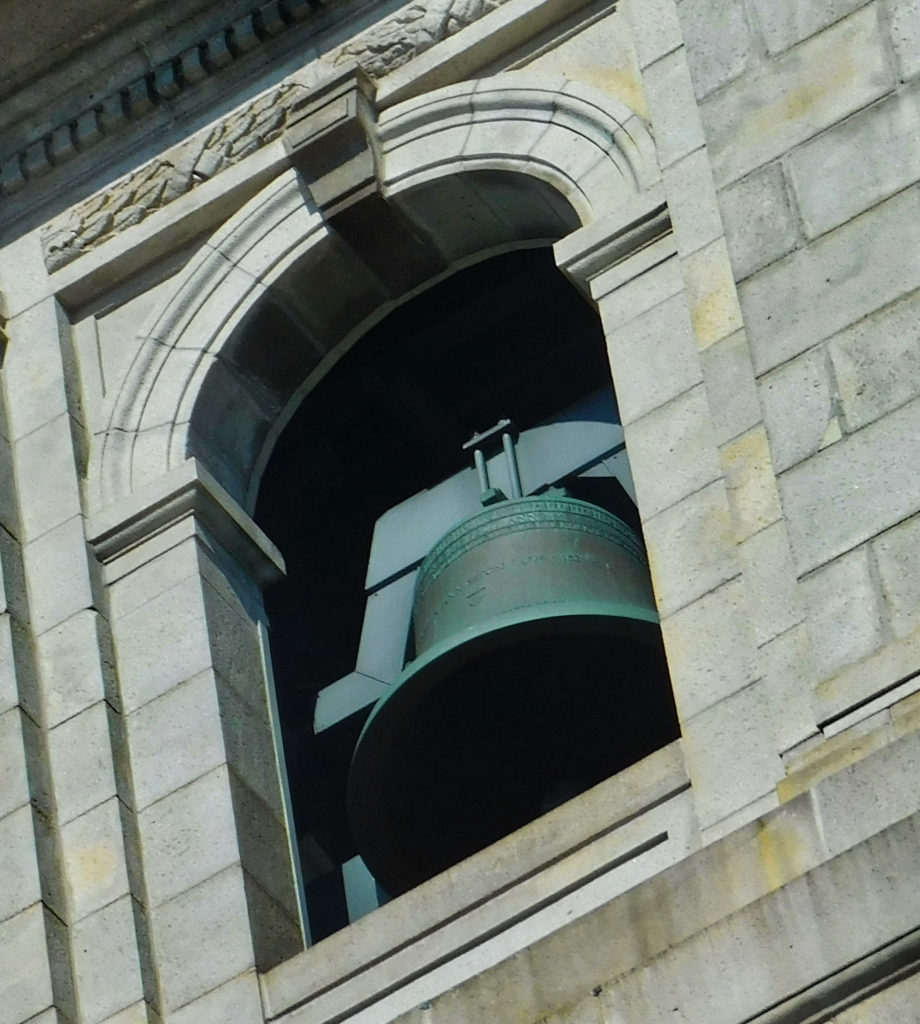
One of the other highlights of the restoration projects over the years included Christmas Eve in 1998. New church bells forged in the Royal Eijsbouts Foundry in the Netherlands. Christmas Eve was likely the perfect time for those bells to ring out over the city for the first time. I managed to capture a little bit of the bells at the beginning of the video.
My only disappointment with the Basilica had nothing to do with the church itself. I couldn’t get inside and do justice to the interior renovations because of COVID, of course. But I’ll get in there and show it to you someday.
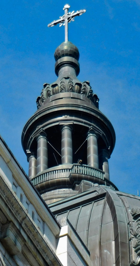
Can you imagine building that type of structure that high off the ground? Amazing… (Photo by Chad Smith)
The front doors at the Basilica of St. Mary’s in Minneapolis. (Photo by Chad Smith)
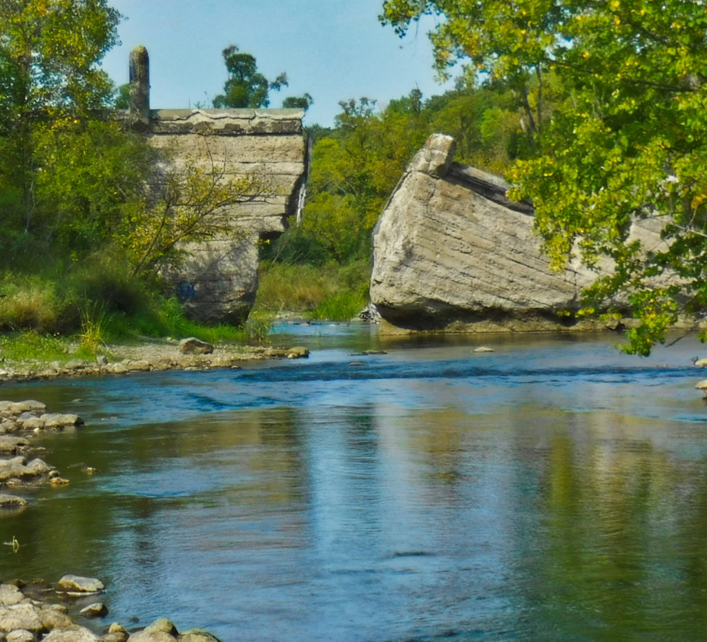
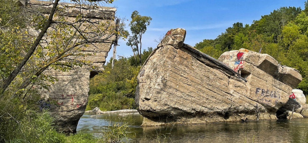
Crookston Lumber Company wasn’t actually located in Crookston, Minnesota, but in Bemidji. It was a big company that processed a lot of lumber during the boom in Minnesota during the 1900s. Crookston Sawmill #1 opened up in 1903.
Lumber barons back in the second half of the 1800s poured millions of dollars into lumber claims in northern Minnesota. Can you imagine being able to pour millions of dollars into ANYTHING back during the 1800s?
There isn’t much left of the Crookston Lumber Company in Bemidji, Minnesota. However, what’s left and the operation’s history are very interesting. (Photo by Chad Smith)
Thomas Shevlin and Frank Hixon purchased several claims and a sawmill from lumber baron Thomas Barlow Walker, calling the operation the Crookston Lumber Company. They opened up 13 logging camps, with each housing as many as 100 lumberjacks.
The year 1903 was when the first sawmill took off. They opened up the lumber mill in a beautiful spot on the south shore of Lake Bemidji. The owners hired 450 mill workers and ran an around the clock operation that is said to have processed 40 million board feet of prime lumber during its first year in existence. Kind of impressive, isn’t it?
I was a little taken aback by how green Lake Bemidji was. Not sure what caused it? (Photo by Chad Smith)
Some competition came along in 1905 for the CLC in the form of the Bemidji Lumber Mill. The location sprang up on the southeast side of Lake Bemidji, so we’re taking very close to the CLC. It didn’t take long for CLC to annex the competition, buying the Bemidji Lumber Mill and naming it Crookston Sawmill #2. Went out on a creative limb, didn’t they?
The height of the operation peaked around 1910 as the Crookston Sawmill drew honors as the second-largest sawmill in the nation. However, the good times weren’t going to last much longer.
This is the remains of Mill #1, which burned down and was rebuilt in the early 1900s. Mill #2 burned down a few years later and wasn’t rebuilt. (Photo by Chad Smith)
As the calendar turned to 1914, fortune took away her smile as Sawmill #1 burned right to the ground. The owners would go on to rebuild the structure soon after the incident. A few short years later, Sawmill #2 also burned to the ground, but the owners would choose not to rebuild the facility.
The end was in sight just a decade later when another fire destroyed about 24 million board feet of prime lumber on November 9, 1924. The retail value on the destroyed white pine was $750,000, an insane amount of money in the early 1900s. The truly-unfortunate piece to the story is 2,000 employees immediately found themselves with no jobs.
The end came in October of 1928 when the Crookston Lumber Mill shut down for good. As it turns out, most of the prime lumber in Minnesota had been harvested, so investors moved their operations out to the Pacific Coast.
This small site is all that remains of what once was the second-largest lumber mill in the United States. (Photo by Chad Smith)
The city of Bemidji sure made a nice little park out of the remains of a once-grand structure. I only wish we didn’t have people who felt the need to tag a building like that. While I usually admire good street art in the Twin Cities, it just doesn’t belong at a place like this. Plus, the fast-food wrappers and empty cigarette boxes don’t add much to the ambiance.
Nevertheless, I still recommend you go see the place.
Anyone familiar with my exploring knows I like taking colorful pictures of street art. This is not the same. We really didn’t need to tag a small sandstone building like this, did we? (Photo by Chad Smith)I’ve seen vegetation grow in the strangest places, including up through a sandstone structure. (Photo by Chad Smith) The Crookston Lumber Company site sits on the southern Shore of Lake Bemidji. (Photo by Chad Smith)
Old Brewery exploring was something I couldn’t pass up. Exploring Minnesota took me to the south this weekend, stopping in Mantorville to check out the ruins of the old brewery caves. There isn’t a lot left of the old four-story, sandstone structure, but admittedly there’s more than I thought I’d see. The once-proud structure is losing the battle to Mother Nature, as you may imagine.
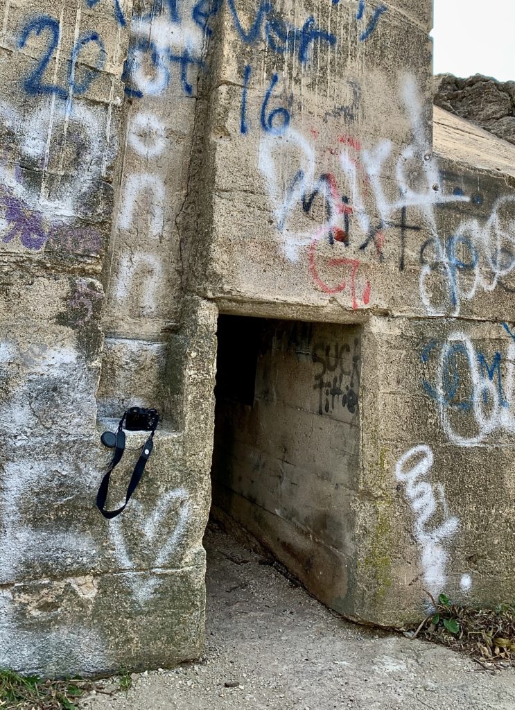
The gated entry to the old brewery. As near as I can figure, what’s inside here was the brewhouse, but don’t quote me on that. (Photo by Chad Smith)
There doesn’t seem to be a ton of information on the brewery online. One source who seemed to know what they were doing says what’s leftover is actually the second brewery built in Mantorville. The original brewery appears to have been built in 1858, entirely out of sandstone quarried out of the bluff directly behind where the structure was built.
The Dodge County Brewery reach four stories at its pinnacle and produced upwards of 7,000 beer-filled barrels a year at their peak in the late 1800s. Reports say the brewery was fortunate in avoiding so many of the fires that claimed other early breweries that began in Minnesota around the same time.
If I pegged it right, this was in the inside of the brewhouse. It’s in rough shape. I did NOT stay in there long at all. (Photo by Chad Smith)
Two 40 X 70 caves were used to store the aging beer and keep the barrels ice cold. The brewery ran purely on steam power during its lifetime. Only a shell of the building remains, but there is one cooling room still intact.
Like many of the other Minnesota breweries, when Prohibition rolled around, that pretty much ended the business. There was some bootlegging during the dry years. When Prohibition was repealed, they tried to crank up production again. New owner Otto Schuman took over the brewery and ran it as a pop factory. But it wasn’t to be. Even though the brewery had some of the largest and most advanced technology of any brewery in the state, Schuman shut down the factory for good in 1934.
The only complete cooling/storage cave I could find left. This is where they stored the beer barrels to keep them cold and age them properly before selling the beer to distributors. (Photo by Chad Smith)
The brewery was partly demolished in 1942. The site did contribute a lot of recovered metal to help the effort in World War 2, but that appears to be its last significant contribution.
Not sure just how long these structures will remain standing. Lots of crumbling down.
Be alert and watch where you step out there. This shot is from the hill above the brewhouse. The littered floor is where I first entered the place and wouldn’t want to accidentally fall into that hole. (Photo by Chad Smith)
Love when structures are made out of sandstone. (Photo by Chad Smith)
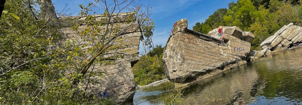
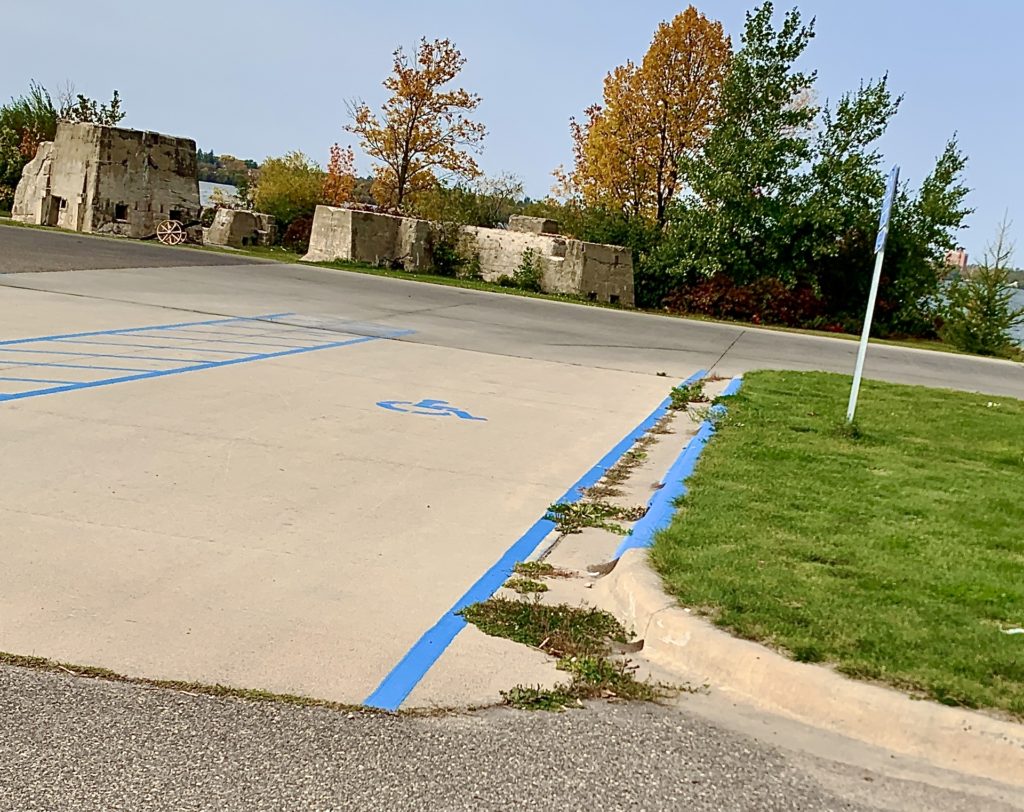
Banning State Park was on my radar for a Sunday afternoon hike and the day couldn’t have been much more perfect. The park is located near Sandstone, Minnesota, which is ironic because the park was once a working sandstone quarry that employed 500 workers back in the late 1800s. You can see the remnants of the old power station building as you walk down the Quarry Loop Trail.
My first look at the old powerhouse building that was part of the Banning Quarry that ran in the late 1800s. (Photo by Chad Smith)
Back in the day, people needed the sandstone for construction and, based on what I saw, there’s a lot of it even to this day. Evidently, the strength of the stone and the pink coloring were in high demand by construction companies.
The place has actually seen its share of tragedy. On September 1 of 1894, the great Hinckley forest fire swept through the area, doing a lot of damage to the quarry and the St. Paul and Duluth rail line that was serving it.
One end of the old powerhouse building that powered the Bannon Quarry, which was located in what is now the Banning State Park near Sandstone, Minnesota. (Photo by Chad Smith)
The business got going again and by 1896, a village was established right above the quarry. It was named in honor of William L. Banning, the President of St. Paul and Duluth Railroad. The village was quickly incorporated into a town of 300 people in 1900. However, the end was in sight for the quarry.
Steel began to take over the construction industry shortly after the dawn of the new century. By 1905, all work at the quarry had come to a close.
As you can probably imagine, with that many trees close together, fires continued to be a problem, and the town of Banning basically ceased to exist in 1912. All that’s left of the quarry itself are a few weathered ruins I have pictured here and on my Facebook page (Link takes you to my photo album).
Getting up close and personal with the ruins in Banning State Park near Sandstone, Minnesota. (Photo by Chad Smith)
Banning State Park was officially established by the Minnesota legislature in 1963, containing more than 5,200 acres. The park was expanded a couple times over the next decades, the last coming in 1986 with total acres numbered at 6,237.
A 10-mile stretch of the Kettle River runs through the park and it is absolutely beautiful. There actually was a dam in the river at one point, but the local Sandstone community, the Department of Natural Resources, and the Pollution Control Agency came together to remove the dam back in 1995.
The interior of the old powerhouse that provided power to the old sandstone quarry in the Banning State Park. I would love to know what it looked like when the place was active. (Photo by Chad Smith)
If you like to ride the rapids, you’ll have options up at Banning State Park. The Kettle River includes five pretty spectacular rapids, including Blueberry Slide, Mother’s Delight, Dragon’s Tooth, Little Banning and Hell’s Gate. The Minnesota DNR website says those rapids will give you one of the most challenging whitewater experiences in the state.
The Kettle River as it runs through Banning State Park. The picture was taken from the “Hell’s Gate” Trail. (Photo by Chad Smith)
It’s beautiful up there. I was totally shocked at the piles and piles of sandstone that are still there to this day. Park workers carved trails directly through several sandstone walls and I bet that took a ton of time to do properly. I’ll admit, the sandstone was fun to climb on but if you aren’t wearing boots, it gets a little slippery. Call it a lesson learned.
Sandstone everywhere. This was out in front of what was the stone cutting shed, according to the park sign. (Photo by Chad Smith)
You can get a map at the park entrance and it costs just seven dollars for a day pass, which I thought was a really good deal. I will tell you that you need to stay on the Quarry Loop Trail if you want to see the old buildings. The signs refer to the Quarry Loop Trail as the “self guided” trail on signs along the way. I’ll warn you and say the trails get a little confusing if you aren’t paying attention and don’t have your map.
Another lesson learned.
I was hoping to see a little wildlife but the best I could do was a woodchuck that ran across my path. Oh well. Make sure you take bug spray. You’ll need it!
Photo by Chad Smith
Seriously? We needed to tag this building all the way up north? Come on, people. (Photo by Chad Smith)
The Power House. Sounds like a great name for a restaurant, doesn’t it? (Photo by Chad Smith)