Anoka’s abandoned amphitheater is a sidewalk width away from the busy traffic on 169. (Photo by Chad Smith)
An abandoned amphitheater? Who could resist that?!
Anoka was my next stop on the exploration schedule to check out an old, abandoned amphitheater. With a hat tip to Brendon Maness for the tip, Derrick and I jumped in the car for a quick drive north on 169 and literally almost ran into the amphitheater as it’s a sidewalk away from 169 itself. Bet the traffic noise made for an interesting background to the entertainment folks put on there, back in the day?
My first impression of the amphitheater was an obvious one: this thing has been around a LONG time. The structure was put together back in 1914 on the banks of the Rum River in Anoka. The really interesting part to me is its name: the Windego Park Auditorium and Open-Air Theater. At first, I thought it was Wendigo. Do you know what a Wendigo is? I bet you do if you’re a monster movie buff like me.
The abandoned amphitheater in Anoka, Minnesota, was first built in 1914. (photo by Chad Smith)
The old theater is currently listed in the National Register of Historic Places and had to be a great place to watch a program back then. The location on the bank of the Rum River is beautiful.
Anoka’s citizens back then had a notable interest in outdoor entertainment and recreation. Thaddeus P. Giddings, a promoter of music education who’d been organizing community singalongs in the summer of 1913, took over organizing the programs and entertainment at the amphitheater.
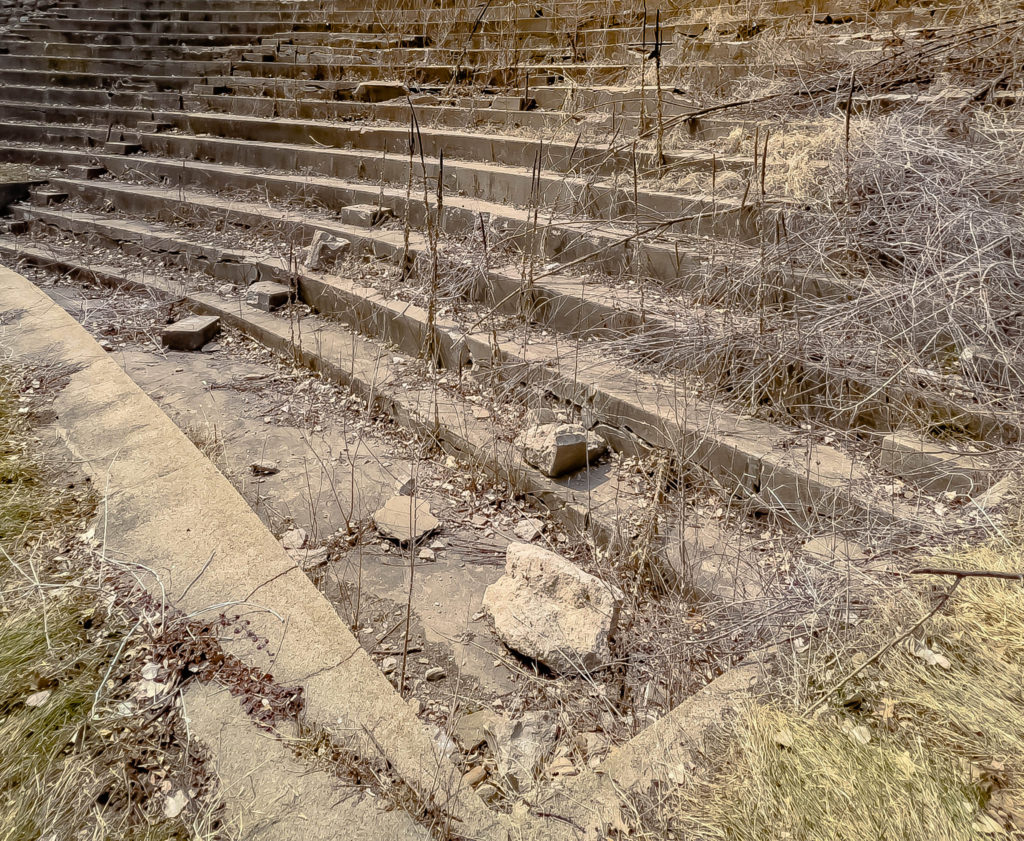
Another gentleman named William Gray Purcell designed the amphitheater, and I thought he did a bang-up job. The stage sits on the flat part of the riverbank, and, as you can see in the pictures, the seats are on the sloping hillside. It had room for an audience of up to 1,600 people in its heyday.
At one time, the abandoned amphitheater held 1,600 people. (Photo by Chad Smith)
At one time, the seating was covered by a colorful retractable awning system designed to protect patrons from the weather. That had to be a must-have during summertime storms and heat waves, am I right? A curved back wall at one time included a box office, entrance doors, and a projection booth, but that part no longer stands.
The orchestra pit was located at the foot of the bleachers. The stage area was off to the left and was nothing more than a flat part of the riverbank. (Photo by Chad Smith)
The theater was used for amateur plays, historical pageants, and other local community musical or meeting events. However, the theater would only thrive as long as Giddings was on hand. Giddings began spending summers at his music camp located in Michigan, and the amphitheater fell into disuse, with the exception of an occasional gathering.
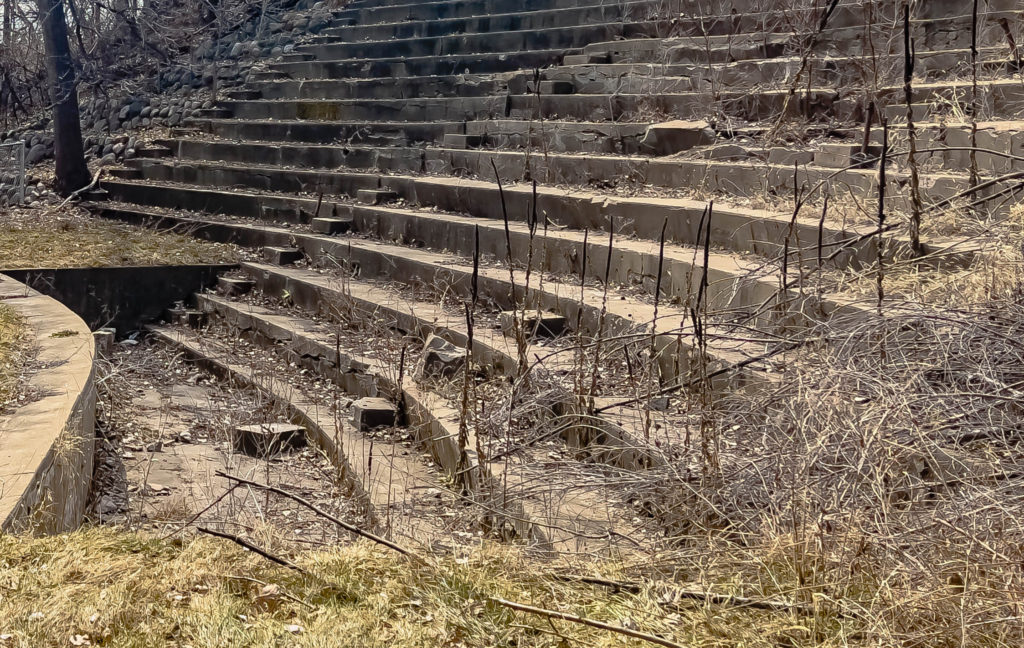
In 1979, Anne Bronken, a University of Minnesota Landscape Architecture Department student, designed a plan to restore the amphitheater. Community organizers patched the concrete and did some cleanup work. A restoration planned as recently as 2010 didn’t happen. Today, the amphitheater has only its seating and orchestra pit left standing, and both are in a deteriorated state.
The view from the amphitheater. The Rum River is in the background and had to make for a fantastic setting to watch a play or concert. (Photo by Chad Smith)
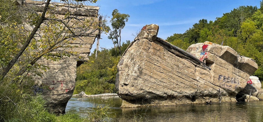
Fergus Falls was calling me over the weekend, and that call finally proved irresistible. I’d heard through the grapevine about the ruins of an old dam along the Otter Tail River that collapsed back in the day. Well, I quit listening after the word “ruins” because I already knew I wanted to see “Broken Down Dam Park.”
Here’s a short video tour of the broken dam
Folks in that area built what’s called a hydroelectric gravity dam on the river in 1907. The dam was built out of concrete and powered a plant called the Fergus Falls City Light Station. The station provided power to city residents for just a year before disaster struck.
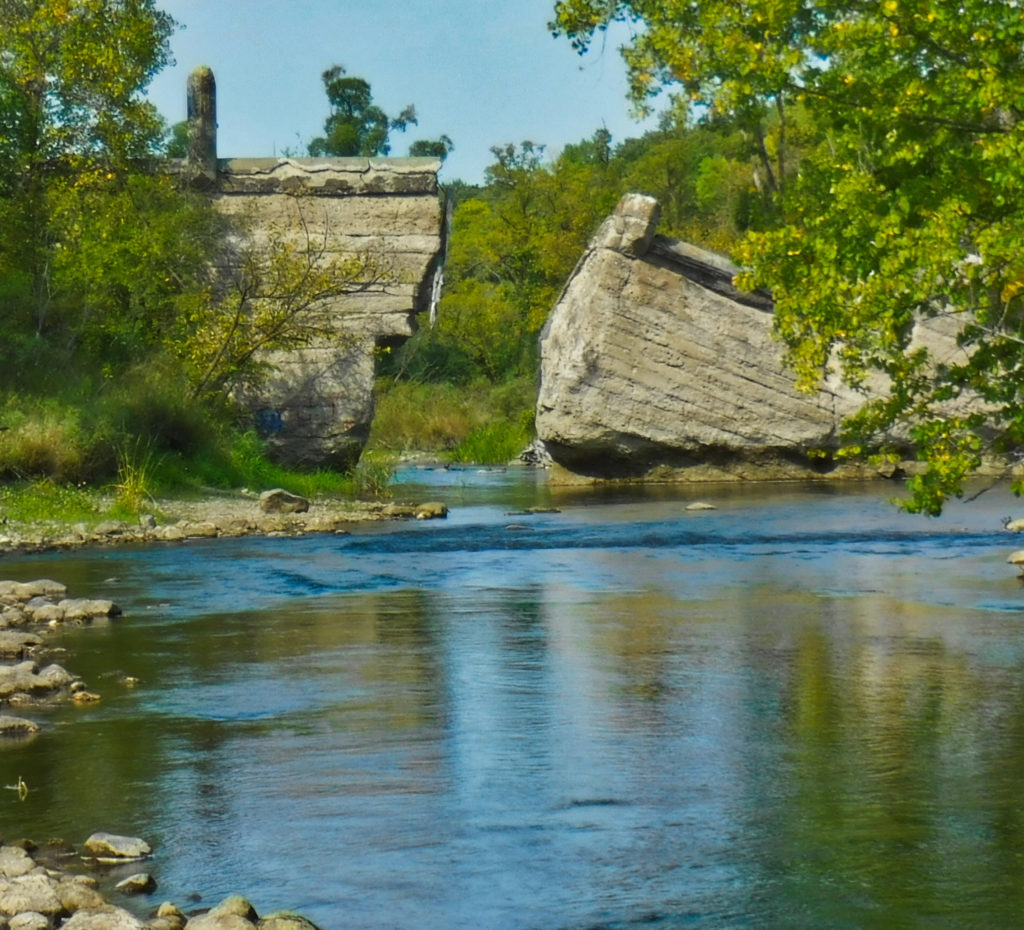
Approaching the Broken Down Dam (Photo by Chad Smith)
The large concrete dam suddenly collapsed in 1909, and you did not want to be downriver from the massive wall of water that suddenly rushed down the Otter Tail River. Can you image the roar of all that water moving at once?
One part of the Broken Down Dam near Fergus Falls that gives the dam it’s name. (Photo by Chad Smith
The dam broke at 4:20 in the morning on September 24, 1909, and the power of all that water releasing at once broke not one, not two, not three, but FOUR other dams downriver. Atlas Obscura says there were reports that the water was so powerful, it picked up a ten-ton generator and threw it into the river. Thankfully, no one died as a result of what was a catastrophe of immense size.
A wiki article (which I was able to validate in several other web pages) says that engineers made a crucial mistake when they constructed the dam. They didn’t conduct a proper site evaluation and wound up building on top of a spring. While I don’t pretend to understand how a spring can flow separately from a river while occupying the same space, it only took a year for the water pressure to build up along the foundations. The rupture washed out the concrete foundation and undermined the structural integrity of the dam, which then collapsed.
The Broken Down Dam, first built near Fergus Falls in 1907, collapsed to to an engineering error. (Photo by Chad Smith)
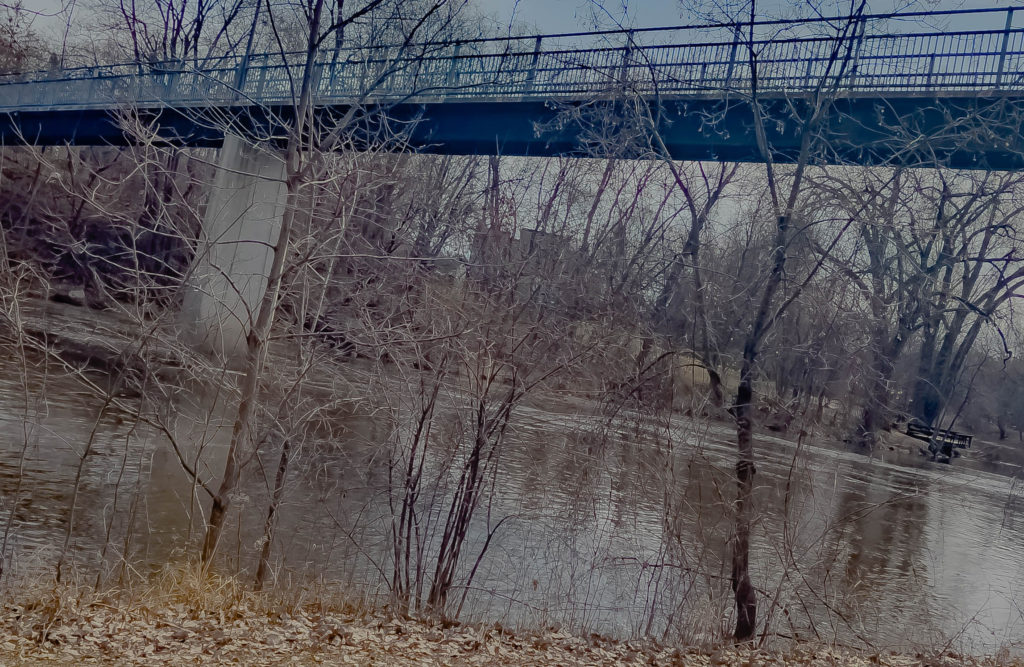
The dam broke in the center, and the rushing water first took out the Kirk Dam, which powered the city’s waterworks. The water then took out the Mount Faith Avenue Bridge before sweeping away the Red River Mill Dam and Woolen Mill Dam. Damage to the two mills totaled $15,000, with the damage in today’s economy equivalent to $432,000 in 2020.
Conspiracy theory alert: The Dayton Hollow Dam, five miles southwest of where the dam broke, was saved from destruction. The dam’s owner, Vernon Wright, had enough warning to hustle down there in time to get the floodgates open. The conspiracy? He also was president of the Otter Tail Power Company.
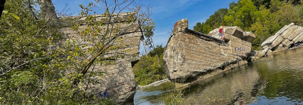
The biggest break in the Broken Down Dam. (Photo by Chad Smith)
The city of Fergus Falls then hired Otter Tail Power to build transmission lines into town. That helped spawn a local rumor, fueled by the newspaper, that Wright deliberately destroyed the city’s dam by secretly distributing quicksilver from a rowboat to undermine it.
Broken Down Dam Park was established in 1949, an 11-acre parcel of land. When the water level on the Otter Tail River is high, the flow can go fast enough between the blocks of the structure to create Class 3 rapids.
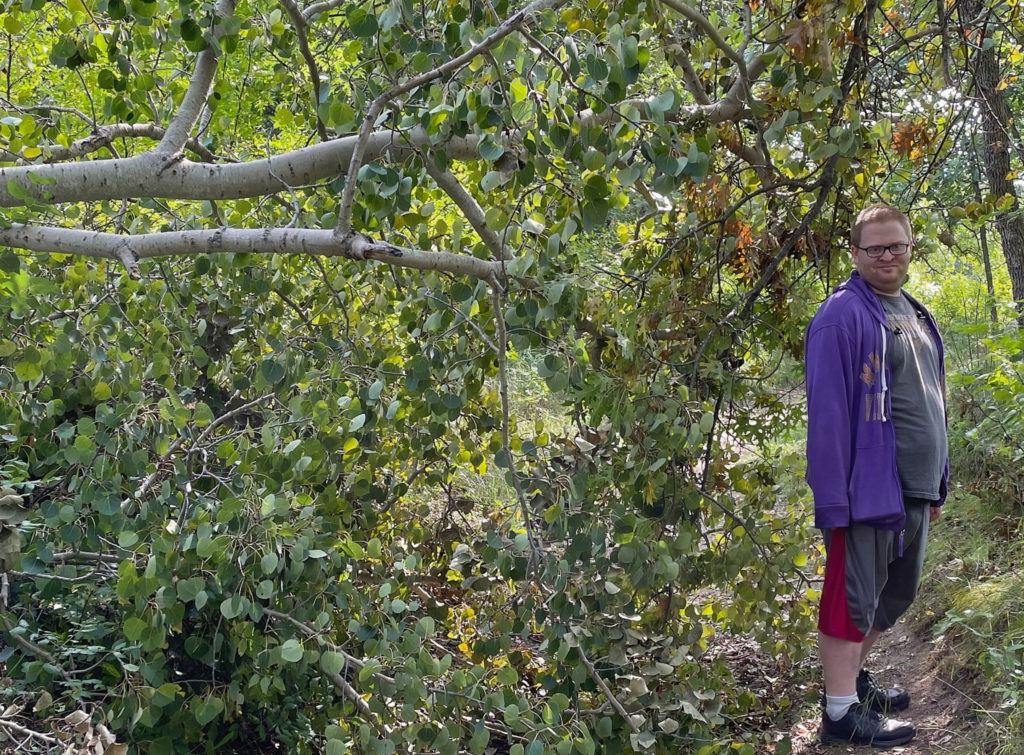
Big tree fell and just about closed the path. (Photo by Chad Smith)
Photo by Chad SmithPhoto by Chad Smith Photo by Chad Smith
Here is the link to my complete photo album from Broken Dam.
Here’s a complete look at the main campus as it stands today.
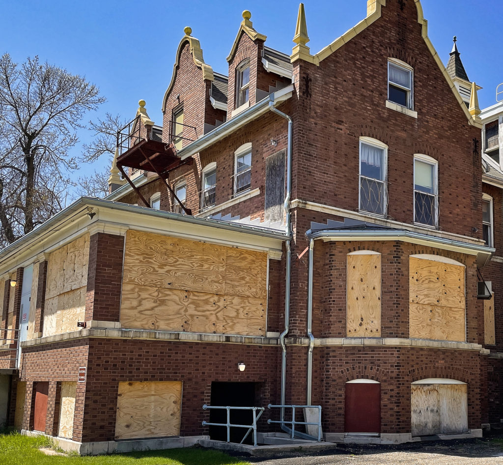
“Anoka State Mental Hospital” – It’s been abandoned since 1999. Just saying the name evokes memories of every single scary movie you’ve watched in recent history, such as those Friday the 13th movies we used to watch as kids. However, like many other abandoned places in the Twin Cities of Minnesota, it seems to be coming back to life.
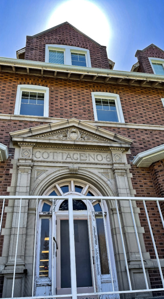
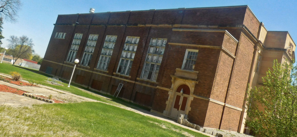
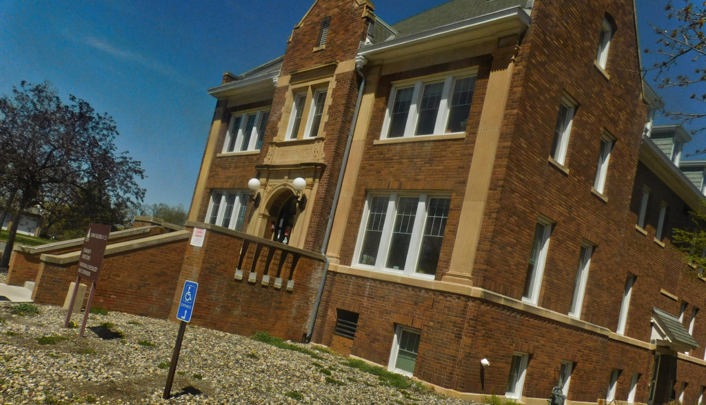
The abandoned Anoka State Mental Hospital is slowly being brought back to life. (Photo by Chad Smith)
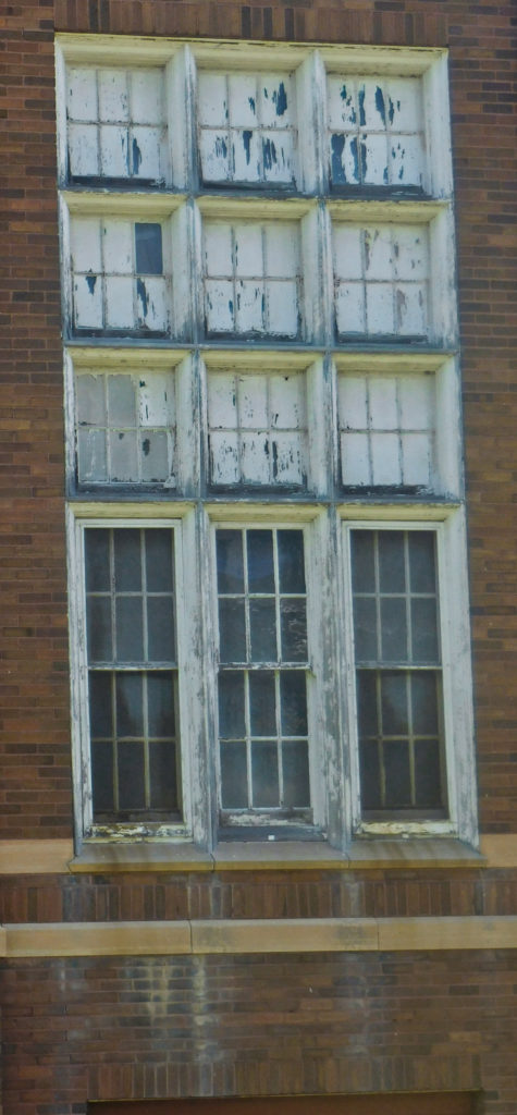
Some of the buildings are still in rough shape, and those are easy to pick out by the plywood in all the windows. Others are in the process of being renovated, and a couple are used now as veterans’ homes. The first thing that jumped out at me was how BIG the campus is. Lots of large brick buildings got built in the shape of a half-circle. It’s enormous!
The brick buildings have every right to look like they’ve been through a lot: they have. A minnpost.com article says the fourth Minnesota state hospital for the insane opened in 1900. The place was quite different from the other three institutions; the Anoka State Mental Hospital was the first to be built in Minnesota according to the cottage plan. The goal was to reduce the institutional feel of the place for its chronic patients.
It was a bright and sunny day when I walked the grounds of the Anoka State Hospital grounds. (Photo by Chad Smith)
They say overcrowding was a big problem at Minnesota’s mental health institutions operating in Rochester, Fergus Falls, and St. Peter. To help alleviate the overcrowding problems, the planning commission chose 650 acres right near the scenic Rum River in Anoka for a fourth site.
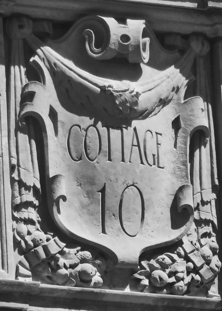
Building the hospital got started in June of 1899, and the first 100 patients (all men) were transferred to the facility on March 14, 1900. The facility began to expand in 1905, adding several cottages, as well as farm and service buildings. By 1917, ten cottages, an auditorium, and a new administration formed in a semicircle at the completed facility.
However, like many mental institutions across the country, history wasn’t always a good thing for the facility. A dramatic series of articles exposed some horrible conditions at the hospital in the mid-1900s. State officials became determined to do something about the problem.
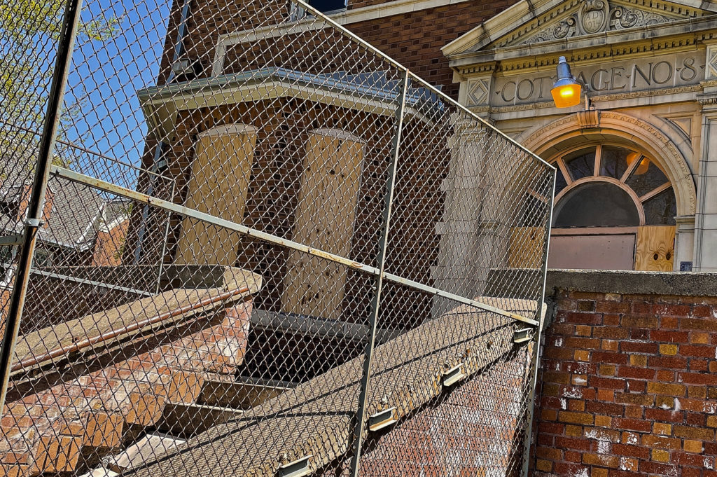
Still some work to do at the Anoka State Hospital. (Photo by Chad Smith)
The atlasobscura.com website says, on Halloween night in 1949, they held a bonfire on the grounds of the Anoka State Mental Hospital. It must have been a big fire as around 359 straitjackets, 196 cuffs, and 91 straps, all different forms of restraints used on the patients, were destroyed. Governor Luther Youngdahl and other officials used the event to show the world that the facility was moving toward more humane forms of treatment.
Conditions did improve for the patients, thanks to the development of new drugs and institutional reforms. Some unfortunate incidents that compromised community safety around the hospital took place here and there over the next several decades. The Anoka State Mental Hospital closed in 1999, and the patients got moved to a nearby facility.
They really don’t want people exploring in their buildings anymore. (Photo by Chad Smith)
Old Brewery exploring was something I couldn’t pass up. Exploring Minnesota took me to the south this weekend, stopping in Mantorville to check out the ruins of the old brewery caves. There isn’t a lot left of the old four-story, sandstone structure, but admittedly there’s more than I thought I’d see. The once-proud structure is losing the battle to Mother Nature, as you may imagine.
The gated entry to the old brewery. As near as I can figure, what’s inside here was the brewhouse, but don’t quote me on that. (Photo by Chad Smith)
There doesn’t seem to be a ton of information on the brewery online. One source who seemed to know what they were doing says what’s leftover is actually the second brewery built in Mantorville. The original brewery appears to have been built in 1858, entirely out of sandstone quarried out of the bluff directly behind where the structure was built.
The Dodge County Brewery reach four stories at its pinnacle and produced upwards of 7,000 beer-filled barrels a year at their peak in the late 1800s. Reports say the brewery was fortunate in avoiding so many of the fires that claimed other early breweries that began in Minnesota around the same time.
If I pegged it right, this was in the inside of the brewhouse. It’s in rough shape. I did NOT stay in there long at all. (Photo by Chad Smith)
Two 40 X 70 caves were used to store the aging beer and keep the barrels ice cold. The brewery ran purely on steam power during its lifetime. Only a shell of the building remains, but there is one cooling room still intact.
Like many of the other Minnesota breweries, when Prohibition rolled around, that pretty much ended the business. There was some bootlegging during the dry years. When Prohibition was repealed, they tried to crank up production again. New owner Otto Schuman took over the brewery and ran it as a pop factory. But it wasn’t to be. Even though the brewery had some of the largest and most advanced technology of any brewery in the state, Schuman shut down the factory for good in 1934.
The only complete cooling/storage cave I could find left. This is where they stored the beer barrels to keep them cold and age them properly before selling the beer to distributors. (Photo by Chad Smith)
The brewery was partly demolished in 1942. The site did contribute a lot of recovered metal to help the effort in World War 2, but that appears to be its last significant contribution.
Not sure just how long these structures will remain standing. Lots of crumbling down.
Be alert and watch where you step out there. This shot is from the hill above the brewhouse. The littered floor is where I first entered the place and wouldn’t want to accidentally fall into that hole. (Photo by Chad Smith)
Love when structures are made out of sandstone. (Photo by Chad Smith)
Banning State Park was on my radar for a Sunday afternoon hike and the day couldn’t have been much more perfect. The park is located near Sandstone, Minnesota, which is ironic because the park was once a working sandstone quarry that employed 500 workers back in the late 1800s. You can see the remnants of the old power station building as you walk down the Quarry Loop Trail.
My first look at the old powerhouse building that was part of the Banning Quarry that ran in the late 1800s. (Photo by Chad Smith)
Back in the day, people needed the sandstone for construction and, based on what I saw, there’s a lot of it even to this day. Evidently, the strength of the stone and the pink coloring were in high demand by construction companies.
The place has actually seen its share of tragedy. On September 1 of 1894, the great Hinckley forest fire swept through the area, doing a lot of damage to the quarry and the St. Paul and Duluth rail line that was serving it.
One end of the old powerhouse building that powered the Bannon Quarry, which was located in what is now the Banning State Park near Sandstone, Minnesota. (Photo by Chad Smith)
The business got going again and by 1896, a village was established right above the quarry. It was named in honor of William L. Banning, the President of St. Paul and Duluth Railroad. The village was quickly incorporated into a town of 300 people in 1900. However, the end was in sight for the quarry.
Steel began to take over the construction industry shortly after the dawn of the new century. By 1905, all work at the quarry had come to a close.
As you can probably imagine, with that many trees close together, fires continued to be a problem, and the town of Banning basically ceased to exist in 1912. All that’s left of the quarry itself are a few weathered ruins I have pictured here and on my Facebook page (Link takes you to my photo album).
Getting up close and personal with the ruins in Banning State Park near Sandstone, Minnesota. (Photo by Chad Smith)
Banning State Park was officially established by the Minnesota legislature in 1963, containing more than 5,200 acres. The park was expanded a couple times over the next decades, the last coming in 1986 with total acres numbered at 6,237.
A 10-mile stretch of the Kettle River runs through the park and it is absolutely beautiful. There actually was a dam in the river at one point, but the local Sandstone community, the Department of Natural Resources, and the Pollution Control Agency came together to remove the dam back in 1995.
The interior of the old powerhouse that provided power to the old sandstone quarry in the Banning State Park. I would love to know what it looked like when the place was active. (Photo by Chad Smith)
If you like to ride the rapids, you’ll have options up at Banning State Park. The Kettle River includes five pretty spectacular rapids, including Blueberry Slide, Mother’s Delight, Dragon’s Tooth, Little Banning and Hell’s Gate. The Minnesota DNR website says those rapids will give you one of the most challenging whitewater experiences in the state.
The Kettle River as it runs through Banning State Park. The picture was taken from the “Hell’s Gate” Trail. (Photo by Chad Smith)
It’s beautiful up there. I was totally shocked at the piles and piles of sandstone that are still there to this day. Park workers carved trails directly through several sandstone walls and I bet that took a ton of time to do properly. I’ll admit, the sandstone was fun to climb on but if you aren’t wearing boots, it gets a little slippery. Call it a lesson learned.
Sandstone everywhere. This was out in front of what was the stone cutting shed, according to the park sign. (Photo by Chad Smith)
You can get a map at the park entrance and it costs just seven dollars for a day pass, which I thought was a really good deal. I will tell you that you need to stay on the Quarry Loop Trail if you want to see the old buildings. The signs refer to the Quarry Loop Trail as the “self guided” trail on signs along the way. I’ll warn you and say the trails get a little confusing if you aren’t paying attention and don’t have your map.
Another lesson learned.
I was hoping to see a little wildlife but the best I could do was a woodchuck that ran across my path. Oh well. Make sure you take bug spray. You’ll need it!
Photo by Chad Smith
Seriously? We needed to tag this building all the way up north? Come on, people. (Photo by Chad Smith)
The Power House. Sounds like a great name for a restaurant, doesn’t it? (Photo by Chad Smith)
Train Depot exploring is something I seriously enjoy. While I do love exploring abandoned structures, it’s a lot of fun to see some of those old buildings redone for use in the present day. I went looking for an old train depot I had heard about in Northfield, Minnesota. I found it, but the “old” depot wasn’t in the shape I expected it to be in.
The building originally dates back to 1888. The depot had an addition built on to it in 1944. The depot’s south wall and roof was removed when the addition was constructed. The building was scheduled for demolition before it was moved but residents didn’t want to lose some of the community’s history. They couldn’t move the new addition because of the cement floor and cement blocks that made up the wall.
You won’t believe just how fast an older white building that was next to the depot came down. Never seen backhoes move quite so fast in my life! 🙂
Some of the bricks that made up the wall in the new addition were salvaged and are already being used to make a sidewalk path on the new site.
According to the information available at the site, I believe the pathway in the foreground was made out of some of the bricks saved from the new addition that couldn’t be moved to the new site. (Photo by Chad Smith)
A group of residents started the Save the Northfield Depot project and moved the structure last January. The old depot was literally moved from the railroad property to a site across the street. The original site has since been graded and cleaned up since then. The new site was chosen because it’s much easier to see. The previous location hid the train depot behind a much larger building.
The depot won’t just sit there and look good, either. Plans are in the works to use it as an information center for visitors. As a side note, I took a drive through the downtown area and it’s picturesque in many spots. Highly recommend a trip through there sometime. But I digress.
They’ve put in a lot of work to refurbish the old train depot in Northfield. It looks to this guy here that the work is going extremely well. Very picturesque old building that looks great! (Photo by Chad Smith)
There will also be a pavilion that residents can use to host events at, as well as an addition for a transit hub, which is a project the city of Northfield will undertake sometime in the near future. A study is in the works on a proposed passenger rail that would connect south to points beyond Minnesota. Northfield would be one of the northernmost stops on the line. The state has even kicked in some money to help fund the study.
Some of their literature I picked up at the site says they’re trying to raise $65,000 for the interior renovation. . The cost could actually be reduced with in-kind materials and labor. They’re also looking for carpenters, plumbers, electricians, and other skilled workers who wouldn’t mind volunteering a little time on the project.
The elderly couple that were outside doing some work on the grounds when I stopped by said this was designed and built by someone in his mid-teens? If I understood them right (hard to hear through their masks, at times), I’d say that was one uber-talented teenager! (Photo by Chad Smith)
Their website is www.northfielddepot.org. They also have a facebook page at facebook.com/northfielddepot. You’ll also find information on twitter at www.twitter.com/northfielddepot.
Place looks fantastic! The old Northfield Train Depot is well on its way to a completely new look and a new purpose in life as a visitor’s information center in Northfield. (Photo by Chad Smith)
Mill ruins are so much fun to explore. Minnesota seems to have its share of these old buildings scattered around the state. Time to Explore Minnesota. We’ve all seen or heard the commercials from time to time, haven’t we?
Well, as I’ve unfortunately had a little more free time lately (thanks COVID-19), I’ve taken that commercial a little more to heart than I have in the past. And yes, I’m keeping socially distant. Instead of feet, my distance between me and other carbon-based lifeforms stretches for miles, okay?
I saw this even before I reached the abandoned buildings of Old Mill Park. Seriously people? On the trees? (Photo by Chad Smith)
After exploring an abandoned farm that didn’t have much left to it, I was off to Hastings next to see their Old Mill Park. That kind of thing is even more interesting to me after spending a couple days poking around Mill Ruins Park in the Twin Cities. While this one wasn’t as big as Mill Ruins Park, the history was just as interesting.
It turns out this is all that’s left of the old Ramsey Mill in Hastings, built back in the mid-1800s. My first thought as I was walking down the path to the old structures was “man they’re tall!” And I was more right than I first knew. The old mill was no less than four stories tall. Alexander Ramsey and Dr. Thomas Foster built it right next to the Vermillion River.
The four-story-tall structure sits right on the bank of the Vermillion River in Hastings, Minnesota. (Photo by Chad Smith)
The big structure was called a “grist” mill. What that means is it ground cereal grains into flour and what were called “middlings.” Those are the parts that aren’t flour. Middlings are a good source of protein, fiber, phosphorus, and other nutrients. People use them to produce foods like pasta, breakfast cereals, puddings, and couscous for humans, as well as fodder for livestock and pets. How about that? You and I learned something today. I didn’t know what middlings were either.
It’s interesting that Ramsey actually sold his interest in the business in 1877 but the place still retained his name. The mill would operate for another two decades before a fire broke out in late 1894. A Wiki article says it unfortunately may have been arson. It was really too bad because the mill had just cranked up its production to 125 barrels a day, higher than it had ever done before.
The Ramsey Mill was hit by a fire in 1894. While there isn’t much of the physical structure left, there’s still a lot of history there. (Photo by Chad Smith)
I don’t actually know when it shut down officially. The oldest photo I could find online was in 1902, when folks in Hastings were already calling it the “Ramsey Mill Ruins.”
As I was leaving the Old Mill Park, I glanced off to the right and saw the most remarkable little tree that seems to be growing right out of the end of the overhang. Those trees can grow in the strangest places, can’t they?
Exploration abandoned Army base. The idea set me on fire Sunday morning, and by Sunday afternoon we were hustling to find one of the best exploration options the Twin Cities has to offer. Much more successful than the day before.
Let me say off the top, the three of us had tried to find this place before. I got a tip from a fellow explorer through the Abandoned Minnesota Facebook Page and we were off to the races. It’s called the Twin Cities Army Ammunition Plant, and there was so much more to it that we ever thought. Here’s the first video, with pics and the plant’s history down below.
A mnopedia.org article says the place was first authorized in 1941, making contributions to the nation’s armed forces for the next half a century.
The most interesting exploration I’ve done to date. The enormous Twin Cities Army Ammunition Plant. A lot to see. Lot’s of American/Minnesota story there for the adventurer. (Photo by Chad Smith)
As the U.S. was building up to World War 2, FDR advocated for the U.S. to take the lead as the “Great Arsenal of Democracy.” His aid strategy was laid out in the Lend-Lease Act. It used government-owned, contractor-operated ammo-manufacturing plants to provide supplies overseas.
The Army Ordnance Department authorized construction of what was then called the “Twin Cities Ordnance Plant.” Sporting ammunition manufacturer Federal Cartridge Corporation of Anoka was contracted to run the facility.
Once the place was fully operational, thousands of workers from across the Twin Cities worked around the clock in three shifts
A lot of Minnesotans did an awful lot of work around the clock to support the Twin Cities Army Ammunition Plant. Best exploration ever. (Photo by Chad Smith)
I talk several times about the scale of the entire place during our exploration. Just to give you a sense of how large the base was, mnopedia.org says it actually began to function “like a small city.” The base had it’s own security/police force, hospital system, fire department, bus system, and a rail terminal. There were social elements to help the people feel more together, including a plant newspaper, intramural sports leagues, and even its own choir to help maintain morale.
The Twin Cities Army Ammunition Plant truly was its own city, with showers, lockers, large cafeteria, and much more. (Photo by Chad Smith)
The initial building we came up to (the subject of the first video) was much larger than we first thought. A couple of the more veteran explorers we’ve run into said it was the actual munitions plant but I have no idea if it’s true or not. It certainly looked big enough, but no matter what, this was the coolest building I’ve been in so far. All it took was a quick duck through a hole in the fence and we were in the front door.
I remember thinking as we walked down the path to that first building, “That’s all there is?” But there was so much more to it. We found what looked like locker rooms, bathrooms, a loading dock near the back, as well as an upstairs to the place. Really a lot of fun! The only thing I didn’t find? Not a single “No Trespassing” sign anywhere.
Those two explorers we talked to said “head east on the path in front of the first building. You won’t believe what you’ll find out there to explore.” They weren’t kidding. I thought the munitions plant building was big. We found a much-larger building to the east, complete with kitchen, multiple full size shower rooms, as well as bunkers, several other smaller outbuildings, and so much more.
One of the things I enjoy most about any exploration is finding old machinery and trying to figure out what it used to do. This one, I have no idea. (Photo by Chad Smith)
By the way, I’ve been looking for a map showing how the buildings were laid out and used. Can’t find one, so if you know differently about something and I’m wrong, drop me a note so I’ll know too?
The most interesting thing to happen when we got to the big building involved long boarders, which I believe are the modern edition of our skateboards we played with growing up. Kylie was taking some video in one of the larger rooms when she heard music playing and had no idea where it was coming from. She played the video back on her phone and as deaf as I am after two-plus decades in radio, I could hear it too.
We’d just watched a found-footage movie called “Sanatorium,” and one of the things the cast found in that big old place was a radio playing music. Why spooky, you ask? It wasn’t plugged in and didn’t have batteries! While I’m not a big believer in the paranormal, I can’t lie and say I wasn’t a little spooked in the back of my mind.
Stairs can always be a little iffy during an exploration but these were rock solid. (Photo by Chad Smith)
The answer itself was decidedly less spooky. There were teenagers upstairs who were hanging out and playing their tunes.
The other thing we noticed was the debris throughout the largest building had been swept to one side of every hall in the place. “Well that’s strange,” I thought. Turns out, there were a couple young guys there with long boards who either found or brought along a big push broom. While it was making the place look much nicer, the smooth concrete floors made for some excellent long boarding, once all the debris was out of the way. Smart!
At the end of World War 2, the plant began gathering up and storing ammunition for the future. The plant cranked up production for the Korean War, the Vietnam War, and every other conflict that took place over the course of its 50-year existence, even drawing a lot of protesters during the Vietnam War.
The street art is another highlight of any exploration as far as I’m concerned. This is fantastic. (Photo by Chad Smith)
Environmental concerns led to an agreement for a big cleanup effort, funded by the Army, which began selling off portions of the property. As near as I can tell, Ramsey County owns the land after buying it in 2013. If there are redevelopment plans in the works, what they plan to build there depends on what source your reading. After doing some research, there are a lot of different ideas on what to do with that place.
However, there is so much land there, wouldn’t it be a little cost-prohibitive? It would be too bad if those buildings went away,. They’d take a lot of American/Minnesota history with them, once they’re gone.
Abandoned places are so much fun to explore. The history, the old structures, and the stories they tell just fascinate me. I have at least three kids in my family that feel the same way I do, so we hop in the car regularly and go looking for neat places to see.
This is what the abandoned Jabs Farm was supposed to look like. However, it wasn’t necessarily what I found on a recent Saturday afternoon. (Picture courtesy of the AllTrails App)
This was a solo trip for me on a beautiful Saturday afternoon. I have an app on my iPhone called AllTrails that shows me great places to hike all around the state. The Mazomani Trail between Jordan and Carver drew my attention because of something called “Jabs Farm.” Another adventurer had posted several pictures of the app that immediately caught my eye.
The Jabs Farm sits in the Minnesota Valley National Wildlife Refuge, which automatically makes it a great place to visit. It’s a lovely place to hike (at your own pace), get some exercise, fresh air, and some beautiful pictures.
Hiking the Mazomani Trail looking for an abandoned farm built in the early 1900s. (Photo by Chad Smith)
The farmstead was first built between 1860-1880. In 1905, the Jabs family bought the property from the Riedel family, who initially owned the property. The Valley News says there are still members of the Jabs family living in the area today. The structures themselves are remarkable, a combination of wood and blocks of local limestone that’s produced in the area. I HAD to see this site.
Exploring the Mazomani Trail, which offered a great view of the Minnesota Valley Wildlife Refuge, first established in 1979. Notice a lot more water than would seem normal? (Photo by Chad Smith
The site was owned by the Jabs family for a long time. Back in 1979, the area, including the farmstead, became the Minnesota Valley National Wildlife Refuge area. The farm was first restored in 1981, and sat untouched until another restoration project in 2017. Believe it or not, the buildings were redone by the U.S. Fish and Wildlife Service. I had no idea they did things like that, but I am sure glad they did.
Heck, they even brought in a full-fledged archaeologist to oversee the renovations.
The views up high of the wildlife area were striking and I’ve got some pictures to prove it. Walking along the bluffs was beautiful that day, with a slight breeze and temps a little over 40 degrees, but it did feel a little warmer than that. It was nice and quiet. I did run into a few people, along with the occasional rustling of the leaves on either side of the trail that likely heralded a squirrel, woodchuck, or some other member of the vermin, err, rodent family.
So after about a 20-minute hike, I came to a split in the trail. One direction would take me to the other trail head, which I had no interest in. But hey, the other one said “Jabs Farm, 1/4 mile” the other way. Well, I came around a slight bend as the trail angled downward and this is what I found.
The most remarkable thing about this? The buildings were less than a quarter mile away and were nowhere in sight. As near as I could tell, they must have been ALL underwater. Wow. That’s a lot of snowmelt in a short time, I guess.
The trees looked like they’d make a great horror movie setting. (Photo by Chad Smith)
As I get a little more experienced in the urban exploration game, I’m finding out that it does take some patience. Not every place you go is going to be “lit,” as the kids say. Let me offer one final example before I leave you.
I got back to the car and realized I didn’t want to head back yet. It was nice to be outdoors and I wanted to see if I could find another place to explore. Well, I pulled up the “Abandoned” app and scanned for something close by. Turns out, there was (supposed to be) and abandoned barn about 15 miles away. Well hey, I’m an old farm broadcaster/writer. Let’s take a look.
Well, needless to say, the app hadn’t been updated. I wound up in downtown Chanhassen. It happens. Hey, at least it was a nice day.