2023, the Ag Economy, and a New Year Ahead

What’s the first thing that comes to mind when I say, “Describe the year 2023 farm economy in one word?” Actually, I’m not sure one word would be adequate, especially if you live and work in rural America. The best way to describe 2023 in the agricultural community for many may be “Is it 2024 yet?”

Ag Economy, 2023
In today’s ag economy, 2023 saw many of us pinching pennies to grow crops.

Dave Widmar is an agricultural economist with Agricultural Economic Insights in West Lafayette, Indiana, and keeps a close eye on the ag economy. We had a conversation during the last National Association of Farm Broadcasting Annual Convention in Kansas City in November, a week before Thanksgiving.

“One of the biggest stories of 2023 is declining net farm income,” Widmar says as the crowd in the Trade Talk event walked by in the background. “That’s not a big shocker to most people in rural America, but we have to put it in perspective. It’s still historically high, so we need to bring it into balance.”

Unfortunately, that income balance doesn’t apply equally to all parts of farm country. He said the Midwest and the Corn Belt did especially well during the last three years combined. In fact, he called the last three years (2021-2023) the “best three-year run” since the 1940s.

“On the other side of the narrative, commodity prices have trended lower,” he said, “especially on corn. We also had another year of below trendline yields combined with higher interest rates.”

AEI isn’t necessarily watching the interest rates the general public hears about during the evening news. Those are the short-term rates the Fed adjusts at their meetings, and, since June, the Fed has raised short-term rates 25 basis points. “On the other hand, long-term rates have increased 150 basis points,” he said.

“That may continue into 2024 as that yield curve un-inverts as we move into a different economy next year,” Widmar said. “As the Fed spent time raising rates, the curve got inverted, meaning short-term interest rates got more expensive than long-term rates. This is often thought of as an indicator that recession may be coming.”
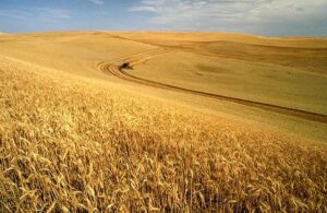
2023 ag economy
The 2023 farm economy showed producers it’s time to keep a tight reign on how they use debt.

Now the Fed has paused interest rate hikes, the long-term interest rates have continued higher. That means the yield curve is starting to un-invert, something he’ll continue watching.

There is some good news for the economy. The unemployment rate remains low, which is a positive trend, and inflation has come down “significantly.” In his words, “the genie isn’t back in the bottle yet.” The country isn’t back to two percent inflation, and the last 150 basis points on inflation are going to be the hardest to reduce. “A lot of moving pieces in 2023,” he added.

So, what do those moving pieces possibly mean for 2024? For those looking for the economy to settle down, they may be disappointed. Widmar said “hold on.”

“The volatility is probably going to continue,” he said ruefully. “That isn’t all bad. Despite record fertilizer prices, the uncertainty around usage, demand, and inflation, the farm economy had a good run between 2011 and 2023.

“We could see some reversion to the mean,” Widmar added. “Farm incomes might be lower next year but not necessarily historically bad. What we need to realize is the last three years are not normal.”

The last three years weren’t typical in terms of government payments, commodity prices, or profitability. Widmar says it’s time to start recalibrating our expectations as to what’s normal and what we should plan on being normal in the future. Speaking of the future, what should producers be thinking about heading into next year?

“One of the big things we’re keeping an eye on is acreage distribution,” Widmar said. “There’s always at least some reallocation. One of the things that we observed in 2023 was that we had a lot of corn acres and not as many soybean acres. That’s resulted in an imbalance in ending stocks.”

That’s put corn ending stocks are above the long-run average, closer to 15 percent than the average of 13 percent. Soybeans are closer to five or six percent instead of the long-run average of eight.

“That means we may see some acreage reallocation,” Widmar said. “Producers should keep an eye on the relative price ratio and how that’s going to impact their budgets.

“They also need to keep an eye on fertilizer expenses,” he added. “Fertilizer has come down a lot recently, and that’s going to benefit corn budgets quite a bit.”

Another thing to watch for is farm debt. One of the things the economists at AEI have observed is new farm loans with different terms than in the past. Take a machinery loan, for example. The payment terms have been stretched out. How does that affect the bottom line?

“For every $1,000 of farm debt one takes on, the payments are going to be about the same as they were the last few years,” he said. “The payment hasn’t changed. What’s changed is the ‘stretching out,’ which means more payments get added to the backside. The extra interest expense is backloaded into the form of additional payments.”

Interest expenses are increasing as we go forward, and it will take more payments to maintain the same level of debt that farmers have had in the past. He said a lot of the economic challenges we face today may be getting “kicked down the road.” But there is one good sign amid some uncertainty looking to the new year and 2024 spring planting.

“Lenders are still confident and comfortable making long-term loans on things like machinery,” he said. “One of the big differences between the 1980s and today is back then, we had very high interest rates and short repayment periods. Some repayment periods lasted less than a single year.”

That created a large problem of no access to capital in the ‘80s. Today, Widmar said there’s a lot of available access to debt markets, which are very accommodating right now. But, he says, just because someone will lend to you at those terms doesn’t mean you as a farmer need to accept them. “Always be thinking about the implications of any loan terms you accept,” he added.

“Stretching the terms out has kept the payments low, but now that we’re in a high-interest environment, how are producers going to adjust,” he asked. If costs like fertilizer, electricity, or gasoline go up, Economics 101 teaches that we should be using less of each input.
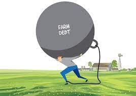
2023 Ag Economy
After a volatile 2023, keep an eye on farm debt and how you structure it.

“What do we do then with the higher cost of money,” he said. “Using less of an input is one particular approach. We can also shift the way we’re using money, including using more long-term debt last year and then shift it to short-term debt going forward. We always have to be evaluating how we’re using debt.”

In closing, he pointed out that agriculture hasn’t been in many rising interest rate environments in the past. The 1980s was one, and farmers and now in another. Producers need to revisit the strategies they’ve been deploying around farm finances, the use of farm debt, and their cash flow.


Weather forecasting looks dry in farm country

Weather forecasting is always an interesting, sometimes confusing, and occasionally a hotly debated topic. No one is more confused than I am. How do you go from an all but snowless winter to 6-8 inches on the ground a couple days before Christmas? I would have been more than happy with a brown Christmas.

weather forecasting
Ryan Martin of Warsaw, Indiana, wears a lot of hats. Grain trader, farmer origination specialist, farmer, and ag meteorologist. He’s the Chief Meteorologist for Hoosier Ag Today. (Photo from hoosieragtoday.com)

But I digress. The dry weather isn’t a good thing for farm country. For the most part, it seems awfully dry from coast to coast across the U.S. So, when I’ve got questions about the weather, I give Ryan Martin a call over in Indiana. I worked for him over a couple of years, helping him to get his weather forecasting ready to be sent to clients. He’s one of the best forecasters I’ve ever come across and I’ve known several of them.

It’s been a dry winter for the most part in U.S. farm country. A pre-Christmas snowfall turned things white in many areas but did little to alleviate the dry conditions. Ryan Martin is an ag meteorologist who lives in Warsaw, Indiana, and says December was well-below average in terms of moisture.

“All things considered, the precipitation that happened in mid-to-late-December didn’t even get the month of December up to near normal over most of the Upper Midwest, Eastern Corn Belt, Great Lakes, and I’ll even throw parts of the Central Corn Belt in there. Overall, we are still well below normal, and the blanket of snow is uninspiring to me at this point.”

He does some weather forecasting for the Upper Midwest and Eastern Corn Belt.

“Temperatures continue to be well-above-normal. By the time we get to January 15-16, we’ll have put enough days in far enough above normal that it’s going to be difficult to see any kind of cold snap bring the entire month back to below-normal levels. Cold air is pooling in Canada, and weather forecasting says it’s going to come down. I don’t think the second half of January will look anything like the first but is it enough to say January is going to flip to cold all over for the entire month? No way, it’s not going to happen.”

There will likely be some cold air incursions into early February, but he doesn’t see any extended cold snaps after that. The Central and Southern Plains will continue to see above-normal temperatures more often than not.

“We’re spending many more days above normal than we are below. Our concern in the Plains is this continued dry stretch.  The overall conditions are not lending themselves to seeing any kind rain come through, or even snow for that matter. We did see a nice blanket of snow in parts of Kansas and Oklahoma out of a winter event a couple of weeks back, but the effects of that are gone now. The wheat greened up a little bit, but I see nothing that says we’re looking at a huge surge of moisture at all over the next 2-3 months.”

Things will likely stay dry and warm in the Delta and the Southeastern States.

“We do have a documented La Nina situation going on. We can see that first of all, from the data coming from the Pacific, but you can see the effects happening down in South America. So, I think as you look into the Gulf Coast states like the lower Delta, we’re already trying to talk about planting or at least getting ready for it here in the next six weeks. I think we’re going to be trending a little bit wet and active, but I guess I’m not concerned about any early hurricane events or anything that will cause a long-term issue in the Deep South. If anything, we’re going to be trending slightly drier there as well.”

The western U.S. will stay dry too.

“Over the Western U.S., generally speaking, we continue to see below-normal precipitation there, and at this point, I don’t see anything that changes that. The high elevations are not seeing any kind of influx of moisture, so I don’t think that fuels anything. I do believe the West Coast is going to stay dry, and La Nina usually helps to fuel that. I’m not going to put this all on a La Nina forecast, but to me, I don’t see anything that says we’re looking at exceptionally-good conditions over the West.”

Again, Ryan Martin is an ag meteorologist from Indiana.

Frost in the Friday night forecast in farm country

Here is the audio podcast with Ryan Martin that you can download to your computer. You can also play it on your mobile device. Just his the play arrow on the left.

Frost in the forecast is rarely a good thing in farm country during any season outside of winter. In an ideal world, the only exception is a killing frost after corn states hit black layer. Of course, we don’t always live in an ideal world, do we? Ryan Martin of Warsaw, Indiana, is a long-time agricultural meteorologist who says the threat of some frost damage will begin this weekend.

“The days most in question are Friday night, May 8, into Saturday morning,” he said. “The axis of the coldest air will come across eastern Minnesota, Wisconsin, east-to-northeast Iowa, northern Illinois, most of Indiana, as well as all of Michigan and Ohio. This is the zone where we’ll see temperatures at 30 degrees or colder.”

He said the coldest air looks to hit Michigan and Ohio this weekend, where we could see some big impact on soft red winter wheat, especially in Ohio. The frost timing is not good as wheat has woken up out of winter dormancy and is moving forward through its growth stages.

“The wheat is at the jointing stage and anytime the crop gets further into its growth, that means the wheat is a little more susceptible to cold temperatures,” Martin said, “depending on how much the temps fall and how long they’re under a certain threshold.

“If wheat is just breaking dormancy and you get a cold snap, you have to be under 28 degrees anywhere between three and five hours,” he added. “When we get into the jointing stage and further along, wheat can barely handle 30 degrees for an hour or two. That’s where the issue lies on wheat this weekend.”

Frost
Ryan Martin, Hoosier Ag Today meteorologist, says the fast pace of planting in 2020 is
going to slow down for a few days due to cooler than normal temps in farm country. (Photo
YouTube.com)

Corn and soybeans will hopefully be a different story. Based on the crop planting progress and emergence reports, Martin, Chief Meteorologist for the Hoosier Ag Today Radio Network, is much more optimistic about those crops being able to survive the freezing temps.

“Illinois leads the way with nine percent of its corn crop emerged,” he said. “In most areas, the growing point of the crop is still going to be below ground, so I don’t think it will mean anything for corn and soybeans on mortality. What it does do is slow down that incredibly fast-paced planting season we’ve seen in many states.”

A couple of other examples include Iowa, which was on a record planting pace during the last planting update, while Minnesota just to the north is no slouch either on planting progress. The Purdue University meteorology graduate says all of the “good stuff” that comes with early-planted corn gets slowed down and “stunted” because of the frost/freeze over the weekend and the extended run of below-normal temps that won’t end till the middle of next week.

“Cold air moved out of Canada and focused on the Great Lakes, Upper Midwest, and the northeastern United States,” Martin said. “However, there’s an interesting twist ahead in the forecast for the next seven-to-ten days. We’ll start to see temperatures in the below-normal areas start to moderate on May 13 through 15.

“Things will take a drastic switch after that,” he added. “We’ll see above-normal temps in the Eastern Corn Belt, while the Plains may drop down below normal through the last part of May. There’s a lot of air currents, different movements here, different patterns trying to emerge, and it all has to do with where polar air is shifting to this time of year.”

It’s been a bit of an unusual spring so far for many reasons, but I’m just talking about the weather. What we’ve seen so far in terms of temps and precipitation has been very different from recent years. There’s no question, a lot of states have seen temperatures consistently lower than what they normally expect.

“Big swings in spring temps aren’t unusual,” says Martin. “We’ve certainly seen them before. I think the reason it’s coming home to roost a little bit more and has people scratching their heads is the degree of change from the last several years.

“We’ve had pretty dog-gone decent springs over the past handful of years,” he recalled. “We’ve come out of winter early and been able to hit the ground running based on the temps. Last year, precipitation was a big problem, but the temperatures were still decent. This year is the first out of the past five or so that’s really showed us the kind of variability we can see in the spring.”

Ryan will do custom forecasts for your radio and TV stations. Check out his work at www.weatherstud.com.

Spring Planting Waiting for Drier Weather

By Chad Smith

Farm country is getting closer and closer to spring planting. Farmers are starting to look at their planters longingly, dreaming of being out in the field. After a wet winter that resulted in serious flooding problems, the nation’s midsection is looking for a spell of dry weather. However, ag meteorologist Ryan Martin of Warsaw, Indiana, says planters are likely going to sit a spell yet. It’s important to remember that we’re way too early to think about seriously-delayed spring planting.

“It probably going to be late this month or early into next month before planters get rolling,” Martin said. “It’s way too early to start thinking about serious spring planting delays. We’re actually not even at first planting dates in a large part of the Corn Belt yet.

Heartland Forecast

“As I look at the pattern stretching all the way from the Great Plains through the Corn Belt, we’ve got a big weather system that wants to move through late this weekend (Sunday, April 7 possibly through early Tuesday the 9th). There won’t be a lot of good drying time after that running through the end of the week.”

After that, there’s another system in the 11-to-16-day forecast that may have 1-3 inches of rain coming across all the key growing areas. Martin says, flooding and current situation aside, the forecast doesn’t give farmers enough of a window in there to really start spring planting en masse.

Spring Planting
The Elkhorn River in Nebraska is way over its banks, covering up a lot of farm ground in Nebraska. Spring planting is likely to be delayed in a large part of the Midwest and Corn Belt because of flooding just like this. (Photo from Omaha.com)

Parts of Nebraska, Iowa, and Missouri have been devastated by flooding this spring, and the dry weather farmers are looking for really isn’t going to happen. “I don’t think so,” he said. “The way the pattern looks over the next 10 days, I’m counting two systems that come through. One won’t have a huge amount of rain, but the second one could bring as much as a quarter-inch to as much as 1.25 inches.

“Normally at this time of year that would be good news,” Martin added. “But, the way things are set up right now it’s just not good.”

Southern Plains/Delta

There are some planters rolling deeper in the Southern Plains and in the Delta. Martin said the weather pattern in that part of the country shows that farmers may have to dodge some thunderstorms in order to keep spring planting going forward.

“Fronts will be coming through but as they do, they won’t hit everyone at the same time,” he said. “Over the next three weeks or so, those storms will end up with about 60-70 percent coverage at any given time. It doesn’t look too excessive to me right now. It’ll be a hodgepodge type of activity that should eventually allow crops into the ground and then get the crops the kind of rainfall they need to get going.”

The pattern for the heaviest rains wants to stay a little farther north into the Central Plains and the Missouri Valley Corn Belt areas. The interesting area to watch will be the far east part of the Deep South, where the likelihood of getting the crop in the ground on time is pretty good.

“Alabama, Mississippi, Georgia, and up into Tennessee are places where temperatures might lag a little behind normal,” Martin said. “There could be some thunderstorm development but I’m not quite as bullish on rain or bearish on getting spring planting in the Deep South done as I am farther north.”

Potential Flooding Possible in Upper Midwest

There won’t be as much happening in the western states in terms of precipitation like there will be in other parts of the country. The biggest story in the western U.S. won’t be in terms of new systems moving through. It’ll more likely involve snowpack runoff. The interesting thing about snowpack runoff is the problems won’t necessarily be just out west.

“The Red River likely will hit major flood stage in eastern North Dakota and western Minnesota,” he said. “There is snowpack that goes all the way back up into Montana and into the northern Rockies. The biggest question is just how fast we’ll see that snow melt and move through the area.

“The question is whether we’ll see a fast snowmelt with temps above normal,” he added. “That could be the story more than new systems coming through. Temperatures are still a little squirrely as temps likely will lag behind normal due to all that snowpack that still sits on the ground in those areas I mentioned.”

Here’s the entire conversation: