Boom Island in Minneapolis – Take Two

Boom Island Park in Minneapolis is one of my favorite places to explore in the Twin Cities. In fact, it was the first place I went to when I got bit by the exploring bug. Well, now that Derrick moved to Minnesota, it’s time to start showing him some of my favorite places in the Twin Cities (and there are a LOT of them).

Boom Island
Boom Island Park in Minneapolis and what remains of the island it used to be. (Photo by Chad Smith)

The park actually gets its name from the island that it once was. The island was named for the booms that were used to separate logs floated down the Mississippi River to sawmills powered by St. Anthony Falls (another of my favorite spots). Each log cut along the tributaries of the Mississippi River was “branded” by each lumber company that put its own stamp on the end of is logs.

One of the things I love about Boom Island Park is the big city is on one side, the green (it will be at some point!) and the wide open space of the park on the other side. (Photo by Chad Smith)

They were separated using the stamps and directed to the right mill by men working from Boom Island. The sawmills at the falls were eventually replaced by flour mills. What remains of those flour mills makes up Mill Ruins Park, yet another great place to explore in the Twin Cities of Minnesota.

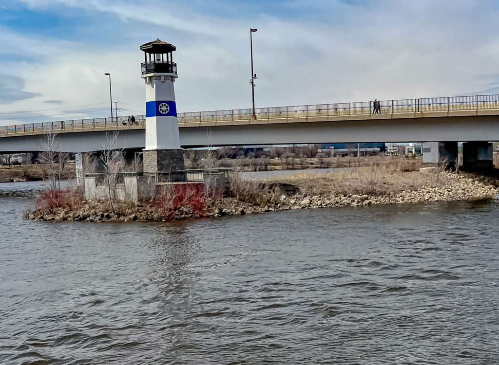
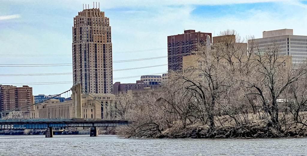
What I love most about the park, besides just how big it is, is the fact that it’s set up next to the Mississippi River. You’ve got the big city on one side, and the open areas of the park on the other side.

Boom Island
My son Derrick appears to be pondered the Mississippi River. He is deep like that :). (Photo by Chad Smith)

The land ceased to be an island a while ago due to a buildup of silt and sawdust. It was bought by the park board with funds from the state legislature through the Metropolitan Council in 1982. The land was bought from a construction company for $2.6 million. That land had been targeted for acquisition in the 1978 plan for the development of the central riverfront as a park by the Riverfront Development Coordinating Board.

At one point, the RDCB even considered converting the land to an island once again, but they decided against it because of the cost. The first phase of the park was dedicated in 1987.

Isn’t this a remarkable old bridge at Boom Island Park? (Photo by Chad Smith)

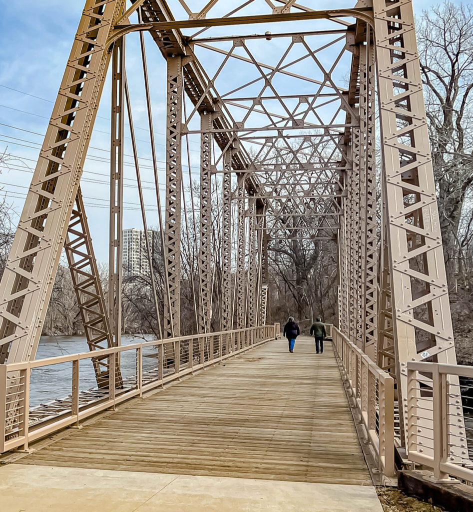
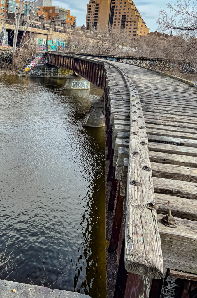
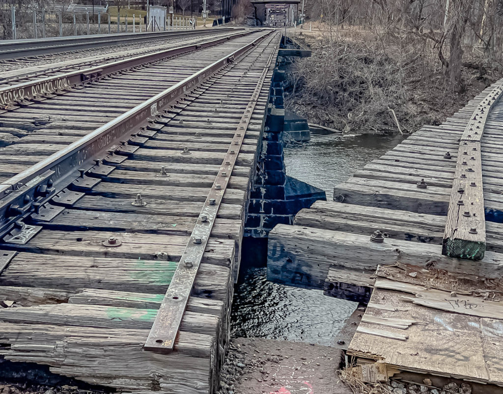
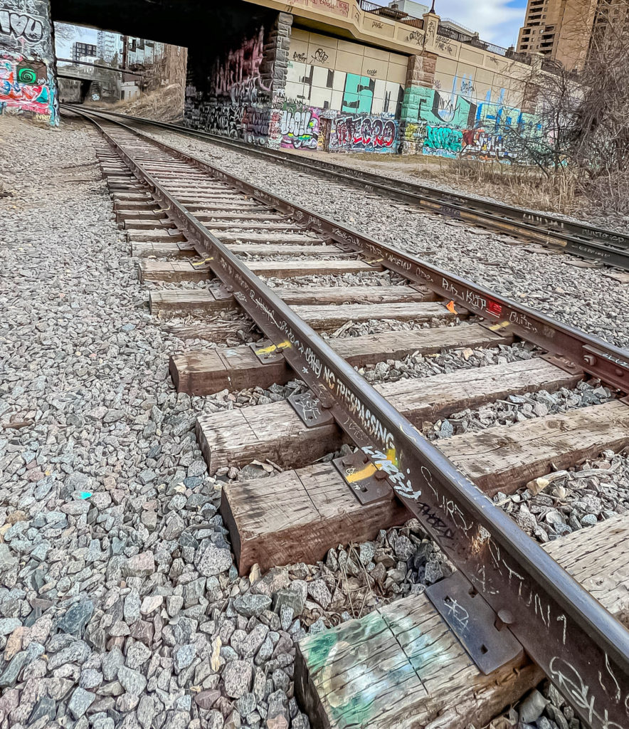
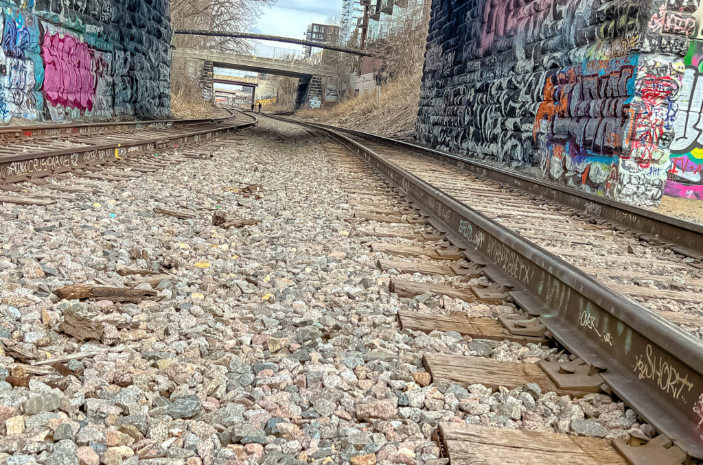
One of my other favorite parts of the park is an old railroad bridge, originally built in 1901 to Nicollet Island, was converted into a bicycle and pedestrian bridge. The bridge was repaired and restored in 2018.

And here is the old railroad bridge. The MOTHER LODE for this old urban explorer.

Boom Island

Photo by Chad Smith

Boom Island
One of my favorite places to go hiking! (Photo by Chad Smith)
What I was most surprised at that day is how many people took hiking trips up and down the tracks. (Photo by Chad Smith)

Here’s the link to my Facebook photo album.

“Fished All Fifty”- Quite an American Journey

“Fished All Fifty.” – the trek is over. A couple young men from the East Coast had quite the pre-college adventure. They’re two people who can say they’ve done something no one else has.

A couple of Virginia men coming through the Midwest recently had a lofty goal of “Fishing All Fifty.” Luke Konson and Daniel Balserak wanted to catch the state fish of every state in the U.S. They recently caught Brook Trout in their home state of Virginia, the 50th and final fish on their list.

Fished All Fifty
Luke Konson (left) and Daniel Balserak recently finished up their goal of catching the state fish of all 50 states. The two men are freshmen at Clemson University this fall. (Contributed photo)

Luke Konson talked about the accomplishment during a phone call from Clemson University in South Carolina. The two Virginia men are both freshmen at the school after completing their fishing plans in less than a calendar year.

“It’s unreal,’ he said with a laugh. “We still can’t believe how quickly we Fished All Fifty. Dan and I had great luck in the last 20 states we had to fish in. While we had to deal with runoff in a couple of places, the trip was mostly full of great weather and helpful people in each location. We weren’t sure we could make quick work of the western states, but we did.”

Being residents of the east coast, they’d never caught any state fish out west, so there was a knowledge gap to overcome in order to Fish All Fifty. Some of the fish they had no experience with included Cutthroat Trout, Golden Trout, Steelhead, and King Salmon.

“In the Dakotas, we were a little more familiar with the Northern Pike and Walleye,” he said. “It’s a little more difficult because many of the fish out there are at least somewhat endangered. But the hardest thing is you have to travel to some very remote locations to catch these fish, which means a lot of driving and hiking to get where you need to go.”

At one point on their trip, they fished in New Mexico, Arizona, Utah, Nevada, and California in five days. Needless to say, that’s a lot of driving all night and fishing all day. After coming so far in their Fish All Fifty attempt, they didn’t want to fall short.

Here’s the rest of the conversation:

Victory at the Jabs Farm – Finally Found It

Victory at last. After an unsuccessful first expedition , I came in from the south and found the Jabs Farm Site located between Jordan and Carver, Minnesota. It’s a long hike through the Minnesota Valley National Wildlife Refuge, but it was totally worth it to see the building remnants that date all the way back to the late 1880s.

Here’s a short video I put together of the site.

One thing about the internet, they’ll sure tell you if you’re wrong. Came in from the north on the first trip and ran into a whole lot of water (flooding). Didn’t know there was another way in. But if you ask for assistance, the internet will also offer that too. And by the internet, I’m talking about the people on social media. Thanks to Brendon Maness, my newest Facebook exploring buddy. Took the time to put together directions so detailed, even I couldn’t get lost.

victory
It took a while but I made it to the Jabs Farm on what I’m calling
the “Chad Smith victory hike.” (Photo by Chad Smith)

If you know anything about me personally, you know I have the direction sense of a wounded bumblebee. Ever seen a bumblebee fly? Nuff said.

You won’t get to park anywhere close to the site itself. I hiked two miles from where I parked to the site. Since my gym shut down over a month ago, it was a much harder hike than it would have been normally. I’m not a man that was naturally gifted with patience when I wanna get somewhere. The walk to victory was much more brisk than the hike back to the car.

The longest structure at the Jabs Farm. I’m just completely guessing but it’s either a storage area for equipment or animals. Again, just a guess. (Photo by Chad Smith)

The Riedel family originally put the farmstead together sometime between 1860 and 1880. Among the ruins of their old barn, one limestone chunk was engraved with “1880.” They worked the land till the Jabs family assumed control in 1905. They would control the land up to 1979, when the land was turned into the Minnesota Valley National Wildlife Refuge.

victory
The old buildings were first put together sometime between 1860 and 1880 by the Riedel
family, who sold it to the Jabs family in 1905. (Photo by Chad Smith)

Just think for a minute about the Riedel family putting that operation together through the late 1800s. They didn’t have the state-of-the-art tools that we have today. That had to be some serious back-breaking labor in order to get those buildings up and going.

There was some restoration work done by Minnesota Fish and Wildlife. If you’re like me, your first though was “what?” However, the agency does maintain and protect a lot of abandoned buildings on their lands throughout the state.

The land the Jabs Farm sits on is now part of the Minnesota Valley National Wildlife Refuge. (photo by Chad Smith)

It’s a great place to go if you want to be “socially distant” from other folks. I didn’t see much more than a half-dozen folks going in and coming out. Like I said, it’s a trek. Mostly flat with some occasional ups and downs. Victory for this old guy felt pretty good!

victory
Love the limestone they used to build their farm structures. Imagine how long it took
the Riedel family to put this together without the top-shelf tools we have available today.
(Photo by Chad Smith)
Absolutely love the limestone they used to build the farmstead. (Photo by Chad Smith)

Here’s the link to my complete photo album on Facebook: https://www.facebook.com/chad.smith.75685/media_set?set=a.3079533055440443&type=3&uploaded=50

History and hiking at the Indian Mounds Loop Trail

History and hiking is one of my favorite combinations. In this day and age of staying at home as much as possible, it’s become an even bigger favorite. You never know what you’ll find around the next corner in any of the dozens of trails around the Twin Cities metro area. The sights to see and the history behind the location are a remarkable combination.

Indian Mounds Regional Park and the Loop Trail that runs through it was my destination of choice. The park gets its name from the six Native American burial mounds that sits on top of bluffs that overlook St. Paul and the Twin Cities in Minnesota. The views up on those bluffs were spectacular.

history
Took a hike and enjoyed some history while walking the Indian Burial Mounds Loop Trail. (Photo by Chad Smith)

At least 16 burial mounds were up there on top of those bluffs at one time. Nineteen more mounds were located further down the bluffs near a place called Carvers Cave. The mounds remain scared to the Dakota Tribe to this day. It’s believed by experts that the burial mounds were created between 1,500 and 2,000 years ago.

Back in the mid-1800s, several scientists with an interest in Minnesota history examined the contents of the mounds that were still left. Experts found different types of burials under the mounds.

Here are just two of the Native American burial mounds you’ll see at the Indian Mounds Park while hiking on the Loop Trail. (Photo by Chad Smith)

The most common types were simple burials. According to the historical information I found, people were buried with mussel shells and an occasional projectile point. Smaller bundle burials were found in the upper parts of many mounds, which meant they were buried by later peoples than the original population. Even more interesting, there were a few tombs made out of logs found at the base of at least three tombs.

history
How high up were the bluffs? Does this give you some perspective? (Photo by Chad Smith)

A couple of the burial mounds had stone cists which were seven inches high and made up of thin limestone slabs which were set upright. Human bones were found in each cist and were accompanied by grave offerings like shells, perforated bear teeth, copper ornaments, a piece of hammered sheet copper, as well as numerous projectile points.

The hike isn’t for the faint of heart. It’s rated as a medium difficulty, which means there are hills. Of course, if you’re going for a workout, it’ll be right up your alley.

Plus, if you like trains, there’s a bunch of trains going by down at the bottom of the bluffs. And I like trains, so it made a fun day that much better.

You’ll find a remarkable view of St Paul and the Twin Cities while hiking down the Indian
Mounds Loop Trail. (Photo by Chad Smith)

history
There’s also a great view of the Mississippi River and lots of boats going by too. (photo
by Chad Smith)


Here’s a link to the Facebook picture album I put together of the hike:
https://www.facebook.com/chad.smith.75685/media_set?set=a.3077319435661805&type=3

Hiking the Winchell trail in Minneapolis

Hiking has to be one of my favorite forms of exercise. The Twin Cities has more than its share of great places to hike. This time I was off to the Winchell Trail.

Winchell. You hear the name and the first thing that comes to mind is the old Winchell’s Donut franchise we used to partake in out on the coast. I went out to hike the Winchell Trail earlier this week and found some interesting old relics from years gone by.

Hiking the Winchell Trail in Minneapolis was a great way to blow off some steam. (Photo by Chad Smith)

It’s an five mile out-and-back trail, so don’t plan on going in a big circle. It’s pretty much a straight shot, no matter which direction you head in. The trail itself runs from 44th Street up to Franklin Avenue, right along the west bank of the Mississippi River. The first thing I noticed was that the flooding along the Mississippi River appears to be lowering. I could see a lot more of the riverbank than I had since early last summer.

There’s a bike path up by the road, with the walking trails further down in the trees. The bluffs are absolutely scenic. If you walk the entire trail, you’ll see sandy beaches, an oak savannah restoration project, and what’s called a floodplain forest.

However, the one thing that did NOT make me happy was all the road construction. It’s a freaking TWO-LANE roadway, with one of the lanes blocked off by those little orange things that seem to sprout up every spring. Makes parking down there even more of an adventure (pain in the ass) than it already is. But, I digress.

Hiking
Hiking along the Winchell Trail and wondered what kind of a wind gust must have blown through to t
take this big boy down? (Photo by Chad Smith)

The Winchell Trail is described as a moderate trail designed for all hiking skill level. The out-and-back trail has a total elevation gain of 500 feet.

Looks like a staircase from a Lord of the Rings movie, doesn’t it? (Photo by Chad Smith)

Hiking
The view of the Mississippi River from the bluffs along the Winchell Trail in the Twin Cities. Bet
it looks even better when everything is greened up? Come on spring! (Photo by Chad Smith)

Here’s the link to the rest of the album on Facebook. https://www.facebook.com/chad.smith.75685/media_set?set=a.3051593368234412&type=3&uploaded=7

Abandoned Jabs Farm Near Jordan, MN, Was Underwater

Abandoned places are so much fun to explore. The history, the old structures, and the stories they tell just fascinate me. I have at least three kids in my family that feel the same way I do, so we hop in the car regularly and go looking for neat places to see.

Abandoned
This is what the abandoned Jabs Farm was supposed to look
like. However, it wasn’t necessarily what I found on a recent
Saturday afternoon. (Picture courtesy of the AllTrails App)

This was a solo trip for me on a beautiful Saturday afternoon. I have an app on my iPhone called AllTrails that shows me great places to hike all around the state. The Mazomani Trail between Jordan and Carver drew my attention because of something called “Jabs Farm.” Another adventurer had posted several pictures of the app that immediately caught my eye.

The Jabs Farm sits in the Minnesota Valley National Wildlife Refuge, which automatically makes it a great place to visit. It’s a lovely place to hike (at your own pace), get some exercise, fresh air, and some beautiful pictures.

Hiking the Mazomani Trail looking for an abandoned farm built in the early 1900s. (Photo by Chad Smith)

The farmstead was first built between 1860-1880. In 1905, the Jabs family bought the property from the Riedel family, who initially owned the property. The Valley News says there are still members of the Jabs family living in the area today. The structures themselves are remarkable, a combination of wood and blocks of local limestone that’s produced in the area. I HAD to see this site.

Abandoned
Exploring the Mazomani Trail, which offered a great view of the Minnesota Valley
Wildlife Refuge, first established in 1979. Notice a lot more water than would seem
normal? (Photo by Chad Smith

The site was owned by the Jabs family for a long time. Back in 1979, the area, including the farmstead, became the Minnesota Valley National Wildlife Refuge area. The farm was first restored in 1981, and sat untouched until another restoration project in 2017. Believe it or not, the buildings were redone by the U.S. Fish and Wildlife Service. I had no idea they did things like that, but I am sure glad they did.

Heck, they even brought in a full-fledged archaeologist to oversee the renovations.

The views up high of the wildlife area were striking and I’ve got some pictures to prove it. Walking along the bluffs was beautiful that day, with a slight breeze and temps a little over 40 degrees, but it did feel a little warmer than that. It was nice and quiet. I did run into a few people, along with the occasional rustling of the leaves on either side of the trail that likely heralded a squirrel, woodchuck, or some other member of the vermin, err, rodent family.

So after about a 20-minute hike, I came to a split in the trail. One direction would take me to the other trail head, which I had no interest in. But hey, the other one said “Jabs Farm, 1/4 mile” the other way. Well, I came around a slight bend as the trail angled downward and this is what I found.

The most remarkable thing about this? The buildings were less than a quarter mile away and were nowhere in sight. As near as I could tell, they must have been ALL underwater. Wow. That’s a lot of snowmelt in a short time, I guess.
The trees looked like they’d
make a great horror movie
setting. (Photo by Chad Smith)

As I get a little more experienced in the urban exploration game, I’m finding out that it does take some patience. Not every place you go is going to be “lit,” as the kids say. Let me offer one final example before I leave you.

I got back to the car and realized I didn’t want to head back yet. It was nice to be outdoors and I wanted to see if I could find another place to explore. Well, I pulled up the “Abandoned” app and scanned for something close by. Turns out, there was (supposed to be) and abandoned barn about 15 miles away. Well hey, I’m an old farm broadcaster/writer. Let’s take a look.

Well, needless to say, the app hadn’t been updated. I wound up in downtown Chanhassen. It happens. Hey, at least it was a nice day.

The entire video from start to finish.

Exploring Harriet Island in St. Paul, Minnesota

I went exploring a place that turned out to be so big, it took me two consecutive Saturdays to finish. I took a couple trips to Harriet Island Park in St. Paul, I found the perfect mix of urban area and wide-open spaces, just across the Mississippi River from each other.

Looking at the St. Paul skyline across the river was an amazing view. The old-fashioned architecture is amazing to photograph. When you combine it with some of the newer skyscrapers erected in recent decades, that makes it more interesting for an architecture buff like me. I’m not so into it that I can name you all the different styles of buildings. I just know what I like to look at.

Harriet Island is a great place to talk a walk. The boardwalk along the Mississippi River is really quite spacious, with plenty of room to stop and take pics or videos. In fact, I had some company walking down the boardwalk at one point. I looked to my right and saw a hen mallard swimming alongside, trailed by three of the most adorable little ducklings you would ever see. In fact, this is what they looked like.

They were adorable!

As I walked further down the boardwalk, I saw it split into several different walking/biking trails, so I headed in a southeasterly direction. I was hoping to find the trail that would take me up higher in the surrounding bluffs for some cool pictures, but never found it. What I DID find is a pretty good sunburn. Not much in the way of protection from the sun’s rays on a rip-snorting hot day. That’ll learn me.

Harriet Island
The boardwalk at Harriet Island Park keeps you tight to the Mississippi River in St. Paul. The
view is amazing. (Photo by Chad Smith)

I know what you’re thinking; “Chad, you posted a picture with the first brand-new baseball cap you’ve had in 30 years. Why didn’t you put it on?” Simply put, I wasn’t in the habit yet and I paid for it.

I did come upon an abandoned Union Pacific railroad track. I saw a big old “PRIVATE PROPERTY” sign that didn’t stop me from climbing up to the elevated track in order to snap a few pictures. At one time, the railroad ran all the way across the Mississippi on a bridge. The giveaway that it was abandoned is the fact that a chunk of the railroad bridge is missing. It was strange. The tracks extends from the other side of the river out into the middle of it. Why not take the whole thing out?

The trails will take you through some wooded areas that reminded me of walking through certain parts of the Black Hills in South Dakota. Beautiful. I was really enjoying the walk until I noticed a discarded couch/roll away bed that someone had tossed into the trees. Why do people do that?

Harriet Island
An abandoned Union Pacific railroad track. Not sure why, but they took a chunk of the track out of the bridge that runs over the river and turned it sideways. Seems a little strange. (Photo by Chad Smith)

It took more effort to carry that couch that far down the path than it would have to hoist it up into a vehicle and drive it to the dump. I know we all get lazy from time to time but we need to be better than that.

Harriet Island
The looks like a big chunk of the railroad bridge that no longer stretches over the water. (Photo by Chad Smith)
I initially thought someone was drilling for oil. Instead, I find out this is the “Target Stage.” Seriously? Does EVERYTHING in the Cities have to have “Target” in the name? 🙂

I saw some really nice boats out on the water. Lots of room on the Mississippi.

Not sure I wanna know what happened to the guy missing this shoe? After all, it IS St. Paul, so who knows?

Harriet Island
Wonder if he or she noticed they’d blown a tire? (Photo by Chad Smith)


There’s an old lift bridge down there on the Mississippi that I’m pretty sure is no longer in use. However, please don’t quote me on that. The blue lift-control house on top of the bridge looks like a pretty lonely place to be?

Harriet Island
I’m not a boating expert by any means, but I think these are some type of retaining walls to
keep ships from hitting the bridge? The doves sure liked hanging out down there in the
shade on a scorching hot day. (Photo by Chad Smith)

You really don’t ever know what you’ll find when exploring the metro area. Found a blushing bride and her groom out getting pictures taken in the Union Depot area of St. Paul.

The blushing bride hurrying to get back and get hitched after taking pictures. (Photo by Chad
Smith)

St. Paul, Minnesota. (Photo by Chad Smith)