Dry Weather in Time for 2021 Harvest

Dry weather is a never-ending talker at the local coffee shops during the growing season, but even more during harvest. Farmers can get a lot of work done in a short time if the weather stays dry. John Baranick (rhymes with ”mechanic”) is a meteorologist with DTN, who says things might be a little drier as harvest continues to speed up across most of farm country.

Drying Off for Harvest

“A high-pressure ridge will continue to move into the Pacific Northwest and will block a lot of moisture from reaching the Upper Midwest for several days,” Baranick says. “Now through the last week of September should be pretty good for getting out there and harvesting the crops.”

The 2021 drought dried out a big chunk of rural America this year, but over the last several weeks, much of the American farm country saw consistent rainfall. Baranick, an Iowa State University graduate with degrees in meteorology and agronomy, says the consistent rain has recharged at least some of the deficit in soil moisture.

“It has,” he said. “We’ve seen some good rainfall in Minnesota, Iowa, the eastern Dakotas, Wisconsin, and Eastern Nebraska over the past several weeks. The level of drought keeps getting reduced in many of those areas. Some areas in the category of D3 drought were eliminated in northeastern South Dakota and northwest Iowa.

“Unfortunately, most of these areas have been so far behind on rainfall that getting almost a summer’s worth of rainfall in a month wasn’t enough to eliminate the drought,” Baranick added.

He estimates that dry weather has put most areas around 6 to 8 inches behind on their average rainfall totals. It’s even worse in western South Dakota. “I was talking to someone that farms out there, and he’s 10 inches behind on their average rainfall total,” he added. “We’re way behind, and it’s going to take a lot of rain to reverse that trend.”

Dry weather
Iowa State University graduate John Baranick is a meteorologist with DTN/The Progressive Farmer. (photo from dtnpf.com)

Baranick, a meteorologist with DTN since 2011, says the fall season will have a lot of variability in the systems moving through rural America. Early September featured some good rainfall, but for the rest of September into October and November, he says they don’t see a strong signal either way of above-normal precipitation that will eat into some of that dryness.

“Some areas may improve a bit while others could degrade,” he said. “I don’t think there’s going to be a lot of movement either way through the fall season. We also don’t see a lot of moisture recharge during the winter season either,” Baranick said.

“Even with good precipitation over the winter, an extra inch or two isn’t going to bite into the five, six, or even eight inches of rainfall deficit we’re looking at,” he said. “We’re going to be dependent here in all these drier areas across the Western Corn Belt, especially the Northwest Corn Belt, for recharging our soil moisture and getting next season’s crop off to a good start.”

Plains Staying Dry Too

Dry weather is affecting he Great Plains from southern Nebraska down through Texas, which makes up the country’s largest winter wheat-producing area. A recent look at the Drought Monitor showed drier areas spreading out quite a bit across even more of Texas, Oklahoma, and southern Kansas.

“We’re looking for some rainfall in many of these areas because it’s also been hot,” Baranick said. “The temps have been above 90 and approaching 100 degrees on many days. The temps have been way above normal, and it’s sucking the moisture right out of the soil. Unfortunately, any systems potentially coming through this week don’t look like they have a lot of moisture.”
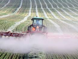
The Plains State have been and still are quite dry in 2021. (Photo from bismarktribune.com)

He says that high pressure setting up in the western U.S. will help keep systems at bay in much of the Plains as well. Unfortunately, the above-normal temps and dry weather in the forecast will continue to sap the remaining soil moisture.

Looking ahead to the fall and winter seasons in the south, we’re heading into a La Niña weather pattern, which typically means warm and dry weather in southern states. These areas seeing their soil moisture drying away don’t have a lot of immediate hope for building that back into the soil.

“For wheat production in the Plains, we’re going to be dependent on moisture coming into the region,” he said. “Hopefully, fall rains will be timely enough to get some good root development in wheat through the fall before they go dormant in the winter.

“We’re hoping that the rains turn on right away when we get out of the La Niña in the spring,” Baranick added. “If we don’t, the winter wheat crop in the Plains is going to be hurting.”

South Finally Drying Up After Storms

Hurricane Ida and Tropical Storm Nicholas brought a lot of extra water to the Southern States and the Delta Region. Moisture coming into the region off the Gulf of Mexico was difficult to turn off.
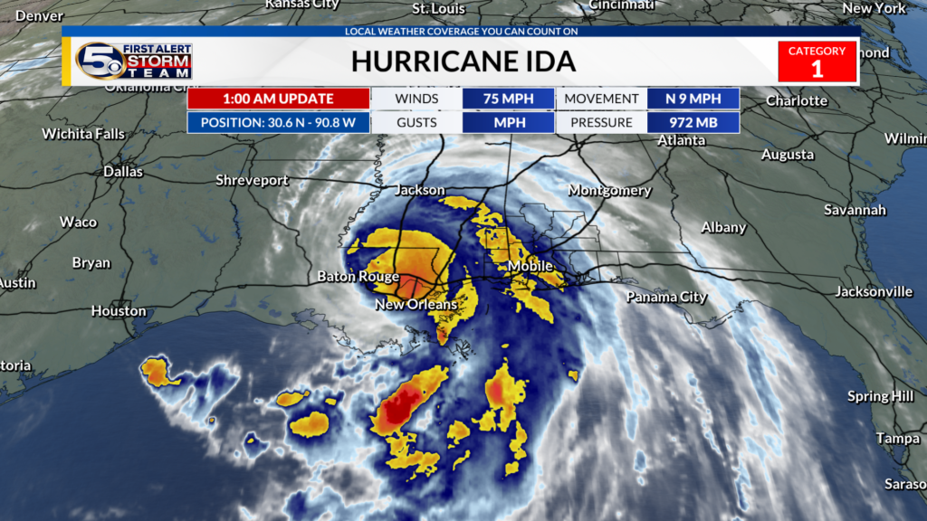
Hurricane Ida, followed by Tropical Storm Nicholas, brought far too much moisture and damage in the south. Drier weather is on the way, so hopefully cotton and soybeans can dry out in time for harvest. (Photo from wkrg.com)

“We will see some dry weather conditions finally get into the South,” he said. “That’s good because it’s going to take a bit for soybeans and cotton to dry off.”

Frost in the Friday night forecast in farm country

Here is the audio podcast with Ryan Martin that you can download to your computer. You can also play it on your mobile device. Just his the play arrow on the left.

Frost in the forecast is rarely a good thing in farm country during any season outside of winter. In an ideal world, the only exception is a killing frost after corn states hit black layer. Of course, we don’t always live in an ideal world, do we? Ryan Martin of Warsaw, Indiana, is a long-time agricultural meteorologist who says the threat of some frost damage will begin this weekend.

“The days most in question are Friday night, May 8, into Saturday morning,” he said. “The axis of the coldest air will come across eastern Minnesota, Wisconsin, east-to-northeast Iowa, northern Illinois, most of Indiana, as well as all of Michigan and Ohio. This is the zone where we’ll see temperatures at 30 degrees or colder.”

He said the coldest air looks to hit Michigan and Ohio this weekend, where we could see some big impact on soft red winter wheat, especially in Ohio. The frost timing is not good as wheat has woken up out of winter dormancy and is moving forward through its growth stages.

“The wheat is at the jointing stage and anytime the crop gets further into its growth, that means the wheat is a little more susceptible to cold temperatures,” Martin said, “depending on how much the temps fall and how long they’re under a certain threshold.

“If wheat is just breaking dormancy and you get a cold snap, you have to be under 28 degrees anywhere between three and five hours,” he added. “When we get into the jointing stage and further along, wheat can barely handle 30 degrees for an hour or two. That’s where the issue lies on wheat this weekend.”

Frost
Ryan Martin, Hoosier Ag Today meteorologist, says the fast pace of planting in 2020 is
going to slow down for a few days due to cooler than normal temps in farm country. (Photo
YouTube.com)

Corn and soybeans will hopefully be a different story. Based on the crop planting progress and emergence reports, Martin, Chief Meteorologist for the Hoosier Ag Today Radio Network, is much more optimistic about those crops being able to survive the freezing temps.

“Illinois leads the way with nine percent of its corn crop emerged,” he said. “In most areas, the growing point of the crop is still going to be below ground, so I don’t think it will mean anything for corn and soybeans on mortality. What it does do is slow down that incredibly fast-paced planting season we’ve seen in many states.”

A couple of other examples include Iowa, which was on a record planting pace during the last planting update, while Minnesota just to the north is no slouch either on planting progress. The Purdue University meteorology graduate says all of the “good stuff” that comes with early-planted corn gets slowed down and “stunted” because of the frost/freeze over the weekend and the extended run of below-normal temps that won’t end till the middle of next week.

“Cold air moved out of Canada and focused on the Great Lakes, Upper Midwest, and the northeastern United States,” Martin said. “However, there’s an interesting twist ahead in the forecast for the next seven-to-ten days. We’ll start to see temperatures in the below-normal areas start to moderate on May 13 through 15.

“Things will take a drastic switch after that,” he added. “We’ll see above-normal temps in the Eastern Corn Belt, while the Plains may drop down below normal through the last part of May. There’s a lot of air currents, different movements here, different patterns trying to emerge, and it all has to do with where polar air is shifting to this time of year.”

It’s been a bit of an unusual spring so far for many reasons, but I’m just talking about the weather. What we’ve seen so far in terms of temps and precipitation has been very different from recent years. There’s no question, a lot of states have seen temperatures consistently lower than what they normally expect.

“Big swings in spring temps aren’t unusual,” says Martin. “We’ve certainly seen them before. I think the reason it’s coming home to roost a little bit more and has people scratching their heads is the degree of change from the last several years.

“We’ve had pretty dog-gone decent springs over the past handful of years,” he recalled. “We’ve come out of winter early and been able to hit the ground running based on the temps. Last year, precipitation was a big problem, but the temperatures were still decent. This year is the first out of the past five or so that’s really showed us the kind of variability we can see in the spring.”

Ryan will do custom forecasts for your radio and TV stations. Check out his work at www.weatherstud.com.

Fire prevention; Are you ready for an emergency?

Fire prevention is a perfect topic that should be top of mind as the winter gets ever closer. We’re all gonna spend more time inside soon. Accidents happen. Are you ready? Here’s a video to warm you up.. it’s only 92 seconds. Take a look.

Ever thought about what would happen if a fire broke out in your home? The recent National Fire Prevention Week means it’s a perfect time to consider the options, such as how to get out of each room in your house if a fire starts? This year’s theme for National Fire Prevention Week is “Not Every Hero Wears A Cape. Plan and Practice Your Escape.”

Fire prevention
National Fire Prevention Week takes place every October and It’s a perfect time to remind
you that winter is coming. We all spend much more time indoors. That’s when accidents can happen. Are you ready? You don’t get a second chance when a fire breaks out. (Photo from starlocalmedia.com)

“National Fire Prevention Week is a perfect time to remind people to think about fire safety, especially as we get closer to winter,” said Rushford Volunteer Fire Department Chief Chad Rasmussen. “Let’s do things like check the smoke alarms, make sure our furnaces are clean, and anything else that would make our homes a little safer.

“People are using their furnaces more in the wintertime, they’re using their wood stoves, and too much snow can block dryer vents,” he added. “There’s a lot of things to keep in mind when people are ‘boxed in’ more during the winter.”

Other preventative steps include keeping chimneys swept and moving snow away from gas meters. Keep space heaters away from things like curtains or blankets that could easily catch fire if the heater happens to tip over accidentally.

Rasmussen said people tend to downplay their chances of having a fire break out in their house. “They really do think it’s never going to happen to them,” he said. “If you aren’t prepared for it, the worst things usually happen. People lose their lives. You could be out of your home. The way we’re building our homes these days makes them burn a lot quicker than they did in the past.”

He said the best way to prepare for a possible fire is to practice an escape plan. People tend to think escape plans are for families with children but that’s not the case. Even someone who lives alone needs an escape plan to get out of their house safely.

“You could be downstairs doing something and a fire breaks out upstairs from a space heater that tipped over,” Rasmussen said. “You need to know how to get out of there as soon as possible. Have a practice fire drill every month or two with everyone in the house. People tend to panic when a fire starts. Make sure what you have to do to escape is drilled into everyone in the house.”

It’s important to have a meeting place picked out that everyone knows ahead of time so you can account for those people in the house. That way, when the fire department does get there, they’ll know right away if they need to check for someone in the house.

The National Fire Protection Association points out that in a fire, people may have as little as one to two minutes to escape safely after the smoke alarm sounds. Escape planning and practice can help make the most of the time you have to get out safely.

“Fire doesn’t care who you are, it’s going to take from you,” Rasmussen said. “It doesn’t matter if you’re male or female, an adult or child, it will take everything from you. Be prepared.”

The Weather stud’s weather forecast

The weather forecast. You know you’re paying extra attention if you live in the Upper Midwest as I do (Minnesota and any of the surrounding states). Simply put, you’re wondering when the white stuff falling from the sky will finally end. After all, it’s getting really hard to find places to pile the extra snow when it’s time to shovel (or snow blow) the driveway. So, I figured it was time to call up my favorite weather guy, Ryan Martin of Warsaw, Indiana, to get a weather forecast of what’s coming for different areas of the country in late winter and early spring.

Weather forecast
Ag meteorologist Ryan Martin speaks during a recent event. Martin is the Chief Meteorologist for Hoosier Ag Today. (photo from hoosieragtoday.com)

“From Iowa and northward through the Upper Midwest, it’s been a very snow-filled winter to this point,” he said. “We’ve exceeded total snowfall amounts in our forecasts by a little bit. One thing you need to note is the fact that it’s still February.

“We generally expect the snowfall patterns to gradually start to ease up in mid-to-late March,” he added. “I think we’re going to be on track to see that this year. Am I calling for an immediate stoppage of now? No. What I do see is temps switching from below normal to normal to slightly above normal. You’ll see more rain mixing in with the snow as March progresses.”

In the weather forecast for the eastern Corn Belt, including the Ohio River Valley, Indiana, Ohio, and the Great Lakes Region, Martin says things take a more active turn as February turns into early March. There’s going to be some “excessive” precipitation moving through that area.

“Temps are going to be on a roller coaster,” Martin said. “We had the brutal cold snap a few weeks ago but are now transitioning into a period during which temps will average out to normal. But, keep in mind that means you could be ten degrees above normal one day and ten below the next day. I’m seeing a lot of rain in the eastern Corn Belt region, which will have a big impact on Ohio River levels, mid-and-lower-Mississippi River levels, and even the Illinois River levels.

Find out Ryan’s weather forecast for the Plains States, the Delta region, as well as the western United States forecast.